Hurricane-force wind gusts affected portions of Montana from Monday night into early Tuesday morning. The peak wind gust was recorded at the Deep Creek weather station, 8 miles east-southeast of East Glacier, at 101 mph. There was also a 97 mph gust in Big Timber. Great Falls recorded a wind gust of 63 mph and there were widespread gusts of 40-60 mph across the rest of central Montana.

Today's Forecast:
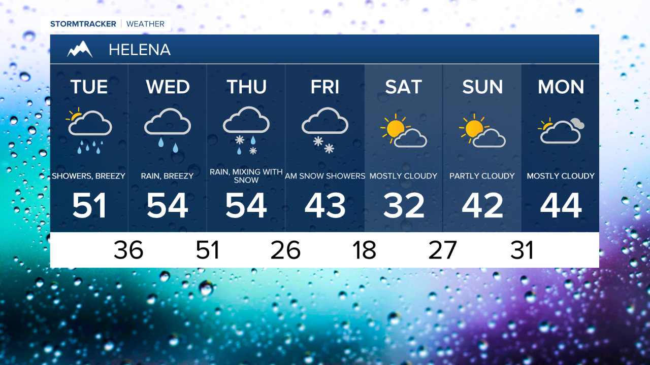
Temperatures this morning were unseasonably mild, ranging from the 40s to 50s. However, temperatures will gradually cool into the 30s and 40s this evening. Scattered rain showers could mix with snow, while steady snow will fall in the mountains. In the lower elevations, up to a slushy inch or two of snow could accumulate, with up to 6 inches piling up in the mountains. Most areas will receive little to no snow.

Another mild and breezy day on Wednesday, with highs in the 40s and 50s (20s and 30s in northeast Montana). There will be another round of strong winds, with gusts over 70 mph possible for the Rocky Mountain Front and adjacent plains, and over 45 mph east of the Rocky Mountain Front. Light rain and snow showers will continue, but snow levels will be relatively high as milder air moves in.
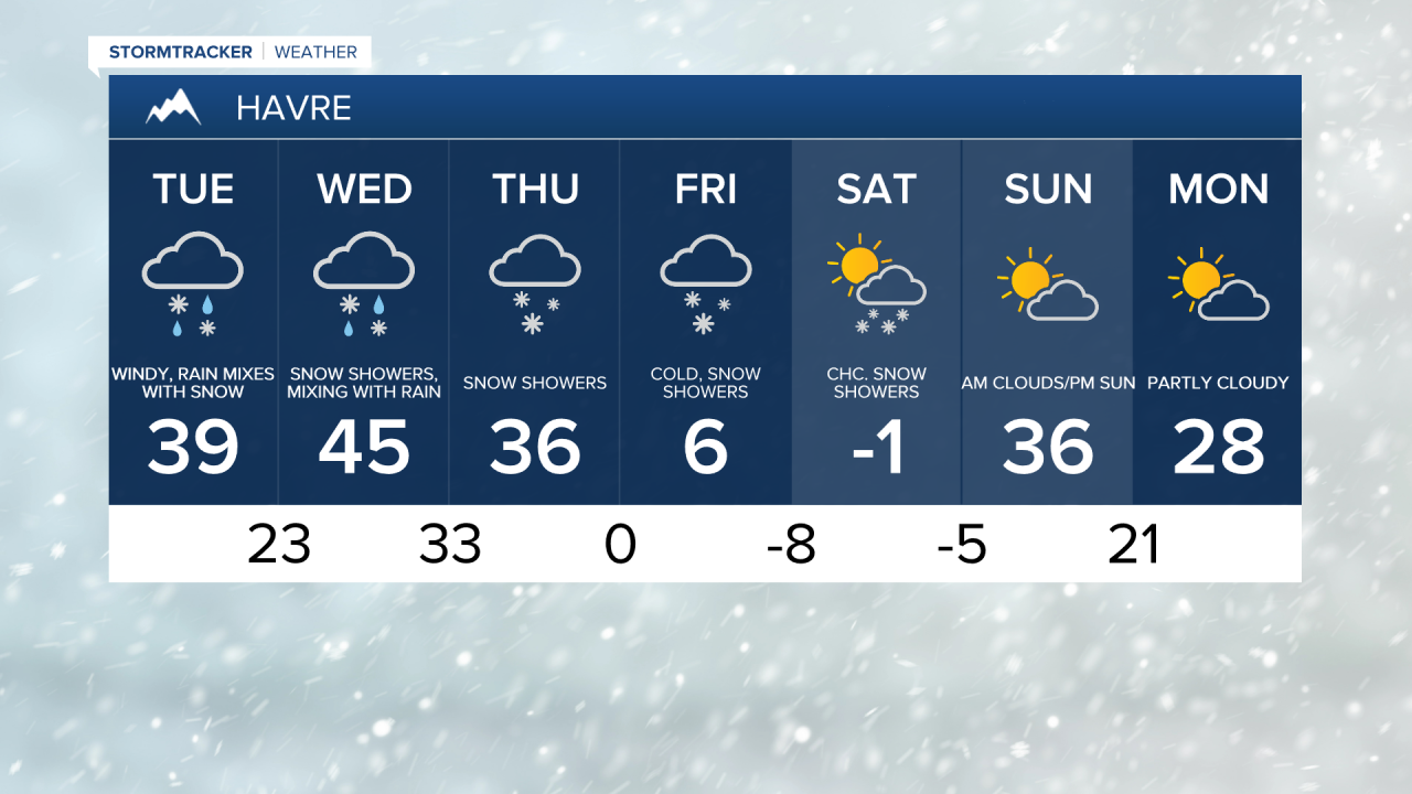
On Thursday, a strong Arctic cold front will push south, with temperatures dropping from the 30s and 40s into the 0s and 10s by sunset. Rain will switch over to snow, and a flash freeze could make roads very icy. Heavier snow is possible along the front, with light to moderate snow continuing Thursday night through Saturday morning. Central Montana could see a significant snowfall, with 3-8 inches of snow likely and isolated locations receiving up to 12 inches. Travel may become difficult at times.
Friday and Saturday will be frigid, with highs in the 0s and low 10s along the Hi-Line, and in the teens and low 20s south of the Hi-Line. Temperatures will not be as cold into Helena, where highs are expected to remain in the 30s.