

BUTTE – Next weather maker will be dropping down into Montana from Canada. A warm front is producing much warmer temperatures Friday afternoon along with gusty winds in many areas and wind prone regions along the continental divide could see gusts over 30 mph heading into tonight.
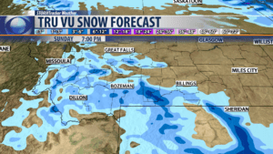
A stronger surface cold front will dig down into the state overnight and could bring rain changing to snow by sunrise. Snow accumulations should be light with an inch or less for many valleys but mountains and passes could see several inches of snow and possible travel impacts.
Gusty winds will also develop with this cold front and behind this front temperatures will be holding steady all day in the 30s.
Friday
City by City Forecast:
BOZEMAN: LOW: 27°; HIGH SATURDAY: 37°. Partly cloudy and mild through midnight. Increasing wind tonight 15-25 with gusts to 30 mph possible. After midnight clouds move in and watch for rain to change to snow by sunrise. An inch or less of snow is possible Saturday morning and surface winds will shift out of the NE 5 to 20 mph and temperatures will be holding nearly steady all day in the 30s.
BUTTE: LOW: 27°; HIGH SATURDAY: 35°. Mild and windy through midnight. A cold front will drop in overnight and will bring rain changing to snow by sunrise. You could see minor snow accumulations early in the day. Temperatures will be much cooler Saturday and surface winds will shift to the North.
DILLON: LOW: 24°; HIGH SATURDAY: 38°. Dillon today’s mild weather pattern will come an abrupt end once a cold front passes through Saturday morning. There is a slight chance for a little rain or snow Saturday morning with minor accumulations for most mountain passes.
WEST YELLOWSTONE: LOW: 20°; HIGH SATURDAY: 36°. Turning colder overnight as a cold front passes through SW Montana. There is a slight chance for morning snow showers and gusty winds. Temperatures will be much cooler all weekend.
PATTERN CHANGE NEXT WEEK:
Starting Monday a blocking high pressure ridge will build over the pacific NW and Northern Rockies. This will bring a warming and drying trend next week into the 2nd to last weekend of October. Warmer than normal highs and lows are coming soon.
