

BUTTE – Another pacific cold front will pass through Montana tonight into Friday morning. This will impact the Friday morning commute across SW Montana with falling snow and gust winds.
Roads could become snow covered and icy Friday morning but with gusty winds look for localized blowing snow and reduce visibility as well. Give yourself extra travel time Friday morning. The storm will be gone by afternoon improving travel conditions but the wind is likely all day Friday.
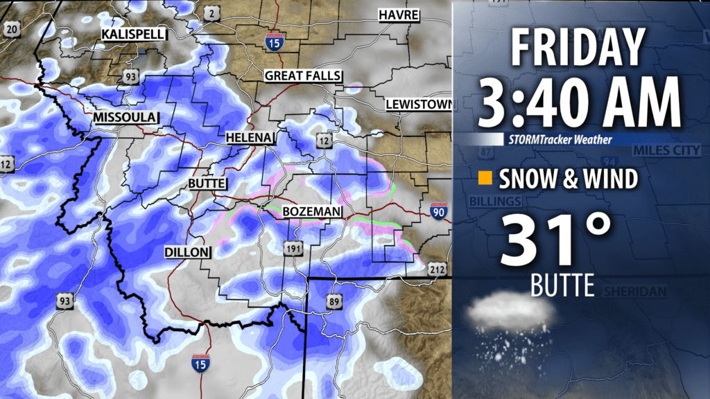
Snow accumulations should be on the light side, however, enough snow is likely to produce icy roads Friday. Mountain passes could see several inches of snow but lower valleys generally under 1″ is possible.

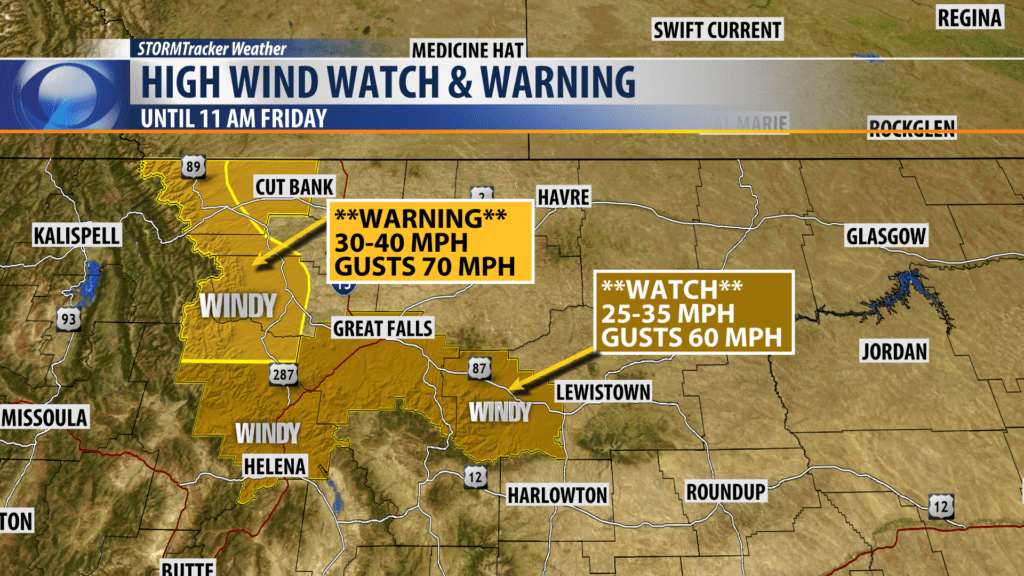
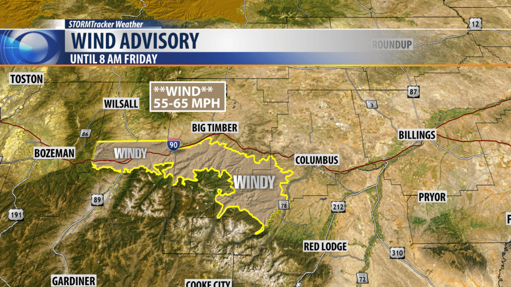
The National Weather Service has a variety of high wind highlights up across the state east of the divide.
High Wind WARNING is up along the Rocky mountain front with possible peak wind gusts 60 to 70 mph.
High Wind Watch is up from Helena to Great Falls and possible peak wind gusts to 60 mph are possible.
High Wind Advisory is up from Livingston to Big Timber tonight into Friday morning with possible gusts to 60 mph.
City by City Forecast:
BOZEMAN: LOW: 29°; HIGH FRIDAY: 37°. Mostly cloudy tonight with light snow by early Friday morning. Snow will diminish by late morning with an inch or less for Bozeman. However, surface winds could increase by morning with gusts to 30 mph. Snow and wind will impact Friday mornings commute. Friday afternoon and evening partly cloudy, cooler and windy.
BUTTE: LOW: 20°; HIGH FRIDAY: 34°. Scattered snow likely after midnight with 1″ – 2″ possible by late Friday morning. Snow will end by mid-day. Look for increasing wind as well, SW winds 15 to 30 mph. This could produce localized blowing snow and travel impacts Friday morning.
DILLON: LOW: 25°; HIGH FRIDAY: 36°. Increasing clouds and surface winds overnight with a shot of snow by early Friday morning. Dillon could see up to 1″ of snow but nearby mountain passes could see 2″ or more. Complicating travel will be the combination of snow and wind. WSW winds 15 to 30 mph are likely tonight into Friday morning.
WEST YELLOWSTONE: LOW: 15°; HIGH FRIDAY: 29°. Snow is likely overnight into Friday morning. Accumulations of 1″ – 4″ are possible. Snow should end by late morning Friday. Increasing surface winds 15 to 30 mph are possible by Friday morning and with falling snow look for reduced visibility and difficult travel.
