

UPDATE:
The National Weather Service has updating a Winter Storm Watch to a WINTER STORM WARNING for SW Montana east of the divide from 11 pm Saturday to 10 am Sunday.
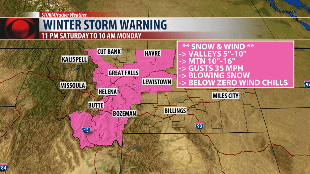
Snow accumulations: 5″-10″ for most valleys and mountains and passes could see 10″-16″ of snow.
Wind: Cold northerly winds are likely as an Arctic front digs into the state with gusts 25 to 40 mph. This will produce some blowing snow and lower visibility and create wind chill values well below zero.
Areas impacted: Bozeman, West Yellowstone, Big Sky, Bozeman Pass, Targhee Pass, Ennis, Dillon, Wisdom, Monida Pass, Raynolds Pass, Twin Bridges, Virginia City.
Look for the current Winter Storm Watch for Butte to be upgraded to a Winter Storm Warning sometime Friday afternoon.
BUTTE – A warm and dry weather pattern will continue into Friday night and Saturday morning but a significant weather pattern change is coming Saturday night into next week.
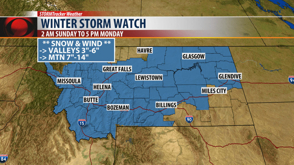
Most of Montana is under a WINTER STORM WATCH which means conditions look favorable for moderate to heavy snow, gusty winds and turning much colder with below zero lows and bitterly cold below zero wind chills.
The watch will be upgraded to either a Winter Weather Advisory or more likely a Winter Storm Warning sometime today or Saturday.
Keep in mind that the most severe weather statement the National Weather Service can make is a WARNING. So please take them seriously as we are trying to protect life and property.
IMPACTS:
Two key weather patterns will likely come together this weekend. First a shot of colder Arctic air and a strong surface cold front digging through the state from North to South Saturday night into Monday morning. This will produce some of the coldest temperatures so far this winter season.
Secondly is a slow moving Low over Northern California that will continue to wrap bands of moisture up into Idaho and Montana and overrun the colder Arctic air at the surface. This could produce moderate and heavy snow at times and produce snow covered and very icy roads Sunday and all commutes Monday into Tuesday.
- Moderate to heavy snow
- Areas of blowing snow and lower visibility
- Below zero wind chills possibly colder than -20°
- Hazardous to dangerous travel both over mountain passes and down in the valley floors
