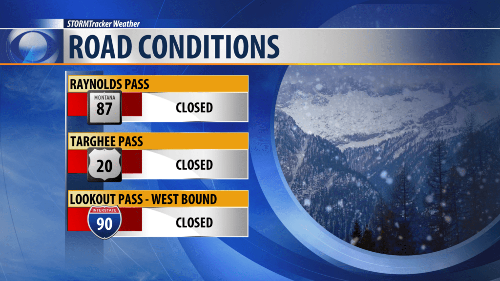
BUTTE – A break in the weather Thursday morning into early afternoon but another shot of snow and wind will impact our region late Thursday afternoon into Friday morning.
High impact areas will continue to be along the MT/ID state line including Monida pass on I-15 and secondary mountain passes heading into Island Park, ID.
Snow should be widespread across the entire region and wind gusts to 40 mph will bring areas of blowing snow and travel hazards tonight into Friday morning.
WINTER STORM WARNING

The National Weather Service issued a new Winter Storm Warning starting at 2 pm Thursday through 2 pm Friday for Southern Beaverhead, Southern Madison and Southern Gallatin counties and into Eastern Idaho and Yellowstone National Park.
Snow accumulations over mountain passes: 6″ – 10″ is possible
Wind gusts: 40 mph or stronger
Impacts: Snow and blowing snow will impact travel at all levels as a cold front passes through and will impact the Thursday evening commute.
WINTER WEATHER ADVISORY
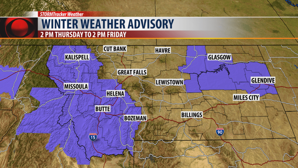
The National Weather Service has issued a new Winter Weather Advisory from 2 pm Thursday to 2 pm Friday. Northern Gallatin, Northern Madison, Northern Beaverhead counties and the Butte/Blackfoot region will see snow and wind and impacts to this evenings commute.
Snow accumulations: Most (not all) valleys could see between 2″ – 5″ of snow according to NWS and mountains passes 3″ – 8″ of snow.
Wing gusts: 40 mph at times will produce areas of blowing and drifting snow.
AVALANCHE WARNING
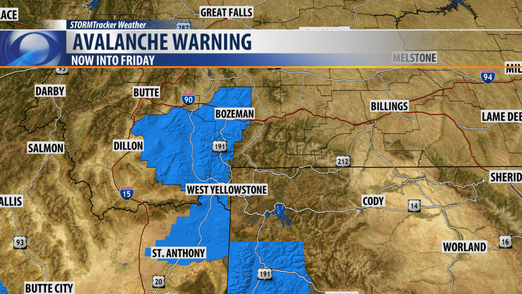
The Gallatin National Forest Avalanche Center issued a Back Country Avalanche WARNING through Friday.
Heavy snow and wind loading impacted areas along the MT/ID state line Wednesday into Thursday morning.
Areas impacted: Lionhead near West Yellowstone, Centennial Range, Southern Madison, Southern Gallatin ranges.
Natural and human triggered avalanches are likely and you need to avoid avalanche terrain and avalanche runout zones.
Another shot of snow and wind will impact this region again Thursday afternoon and evening so look for unstable conditions to continue into Friday and possibly the weekend.
TRAVEL ALERT!
Road closures continue into Thursday afternoon for the same areas that were closed on Wednesday due to blizzard like conditions and snow drifts near Island Park, ID and from an avalanche on west bound lanes on I-90 from St. Regis to Lookout Pass.