BUTTE – Typical April weather pattern is cool and wet through the end of the week. Temperatures will be very close to average through Friday and could warm up into the lower 50s but this will also create a slightly unstable atmosphere in the late afternoon hours so look for a few isolated small thunderstorms.
Up next this weekend a series of storms will pass through Montana producing increasing rain or snow and pushing temperatures back down below average. Late next week an unseasonably cold weather pattern will hit much of the western and central U.S.
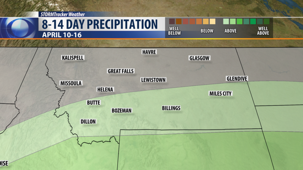
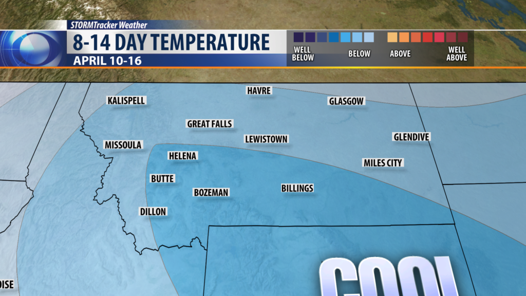
CLIMATE PREDICTION CENTER 8-14 DAY OUTLOOK:
City by City Forecast:
BOZEMAN: LOW: 29°; HIGH THURSDAY: 51°. Scattered showers and isolated thunderstorms are possible Wednesday afternoon and evening. Snow levels Wednesday night should be around 7,000′ with a couple of inches of snow possible. Thursday will be partly cloudy to cloudy with a few pop up afternoon showers and mild.
BUTTE: LOW: 24°; HIGH THURSDAY: 50°. Scattered showers are likely Wednesday afternoon into Wednesday early evening. Partly cloudy overnight and clouds will be building again Thursday afternoon and could produce a few isolated showers.
DILLON: LOW: 28°; HIGH THURSDAY: 54°. Isolated showers and higher mountain snow is likely Wednesday afternoon and evening. Look for a few spotty showers to re-develop again Thursday afternoon.
WEST YELLOWSTONE: LOW: 21°; HIGH THURSDAY: 48°. Scattered rain or snow is likely to impact West Yellowstone Wednesday night into Thursday. Snow accumulations of 2″ – 4″ is possible over nearby mountain ranges and inside Yellowstone National Park.
