BOZEMAN – High-pressure is building over the Pacific NW and producing a westerly flow over Montana. This is helping temperatures rise to normal and slightly above normal levels Wednesday, but it also paves the way for some moisture to pass through the state.
Isolates rain showers and a few isolate mountain snow showers are possible tonight into Thursday morning. As the atmosphere warms slightly in the late afternoon it could increase instability and produce a few isolated thunderstorms Thursday and Friday afternoon.

Total precipitation should be very light for SW Montana through Friday.
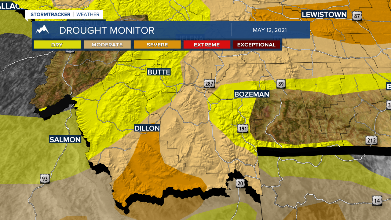
Mid-week snowpack report looks mixed over Montana. Locally, most SW Montana river basins are ranked in the “slightly below normal” range between 72% to 88%. The worst conditions are in the Jefferson basin (Big Hole, Beaverhead, Ruby) with a 65% of average value. The Gallatin is holding a little higher and is considered near normal with 90% of average.

The Montana drought monitor will be updated Thursday but a zoomed in look at SW Montana from last week’s report shows “severe” drought building from Dillon southward to the Idaho border. A broad area of “moderate” drought is also present over SW Montana east of the divide.