BOZEMAN – The weather forecast for this weekend into early next week is diverse with big temperature swings, strong surface wind gusts and rain or snow showers.
The next weather maker is a strong Pacific cold front hitting the NW coast Friday afternoon and slowly moving eastward. This front should pass through Montana Saturday night into Sunday morning.
Ahead of the front temperatures will jump above normal Friday night and Saturday, in fact, there could be numerous lower 80s for highs Saturday afternoon. The flow aloft will swing out of the SW ahead of the cold front Saturday which could thicken up wildfire smoke over SW Montana.
The biggest concern for Saturday is the wind. Increasing surface wind gusts 30 to 60 mph and possibly stronger gusts in high wind prone areas Saturday afternoon. As of 1 pm Friday a High Wind Watch continues for SW Montana east of the divide for Saturday morning through Saturday evening. There should be an update from the National Weather Service later in the day. For now, plan on sustained West to SW winds Saturday afternoon 20 to 40 mph and peak gusts 50 to 60 mph.

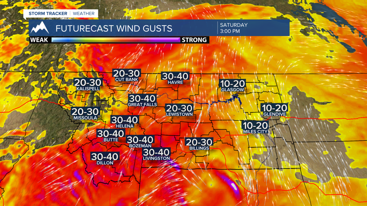
The combination of strong surface winds, above normal temperatures and lower humidity values has most of Montana under a RED FLAG WARNING Saturday morning through Saturday evening. This means conditions are good for possible new fire starts and everyone needs to be extremely careful with all outdoor activities on Saturday as small accidental fires can quickly grow out of control.

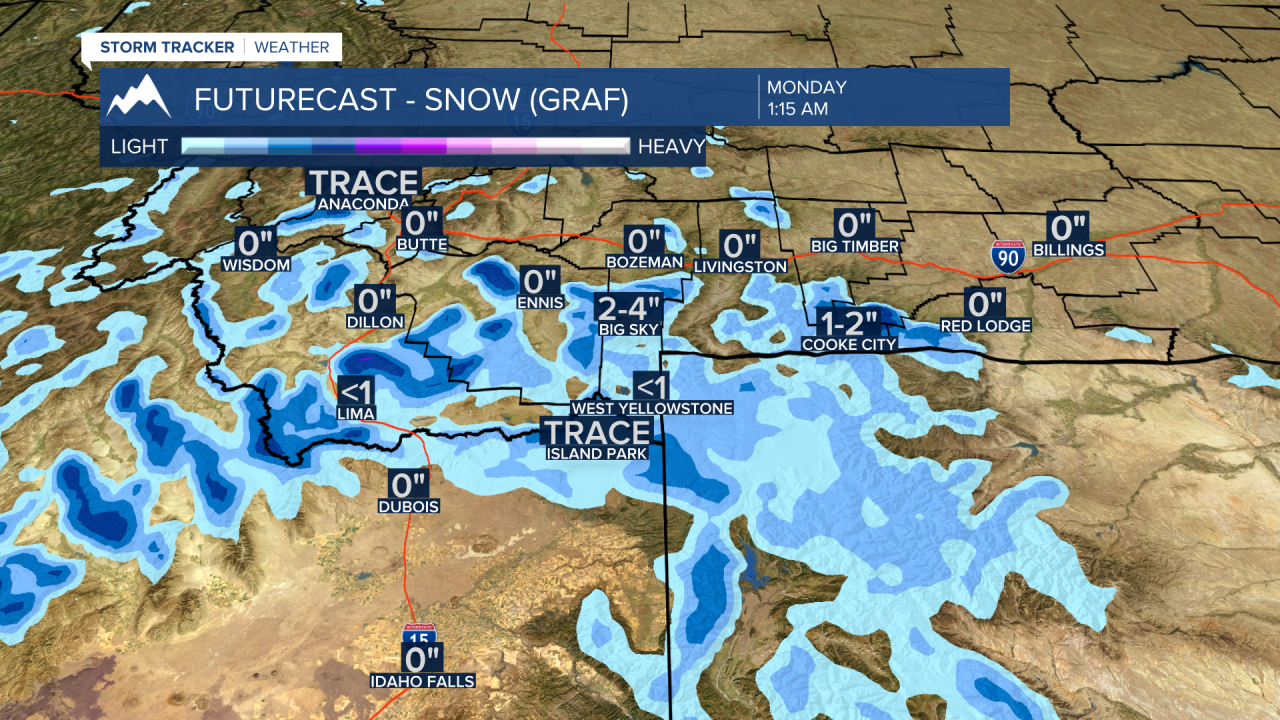
Behind the cold front a slower upper-level Low will pass through the state Sunday into Monday. Considerably cooler air with moisture will dig into SW Montana, especially Sunday night into Monday morning.
There will be accumulating snow over most mountain ranges south of I-90 by Monday morning. Accumulations should be around 2”-4” above 7,000’ and possibly more for the highest peaks. This is an early estimate and forecast totals could change with updated model runs over the next day or two. Regardless of how much snow is possible the point is you need to be prepared for changing conditions in the backcountry if you are recreating this weekend into early next week. Colder temperatures, rain or snow, gusty winds will have a significant impact late this weekend into early next week.