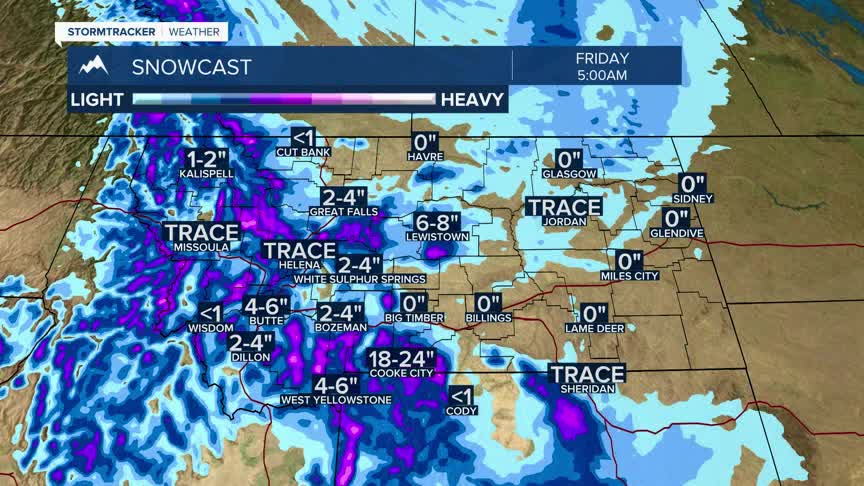


BOZEMAN– Another great wet weather maker is coming to Montana. The next Pacific storm arrives Wednesday night and will linger through Friday afternoon.
Just like the storm this one will begin as rain and could change to snow at all levels with slushy road conditions possible for mountain passes Wednesday night turning to snow and ice by Thursday evening into Friday morning.
There are Winter Storm Watches up for the Madison, Gallatin, and Bridger ranges in SW Montana extending into central Montana.
Winter Weather Advisory is also up for Island Park, ID and across Yellowstone National Park Wednesday afternoon through Thursday evening.
The storm should exit the region by Friday but the cooler air will continue to sit over Montana through the weekend. Temperatures will fall into the 30s with the storm Thursday and Friday, and morning lows could drop into the teens.
