

BOZEMAN – Another blast of winterlike weather will impact Montana this weekend with accumulating mountain snow and a rain/snow mix for the lower valleys.
High-pressure is currently exiting the region, and a large Pacific Low-pressure system is lurking off the NW coast. This Low will dig into northern California and begin to lift to the NE this weekend, producing increasing moisture and considerably cooler air.
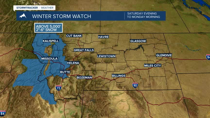
The National Weather Service has issued a WINTER STORM WATCH for all areas west of the divide above 5,000’ with 2”-6” of snow possible Saturday night through Monday morning. Locally heavy snow is possible for higher peaks.
There will likely be additional winter weather highlights issued for the rest of SW Montana soon.
Forecast highs from Sunday into Monday will drop into the upper 30s to lower 40s and morning lows below freezing. This could lead to wet and icy road surfaces Sunday through Monday.
