BOZEMAN – The weather pattern is improving nicely Tuesday afternoon with the help of clear skies and sunshine thawing area roadways. A word of caution, those wet roads this afternoon could re-freeze after sunset and create icy conditions overnight into Wednesday morning.

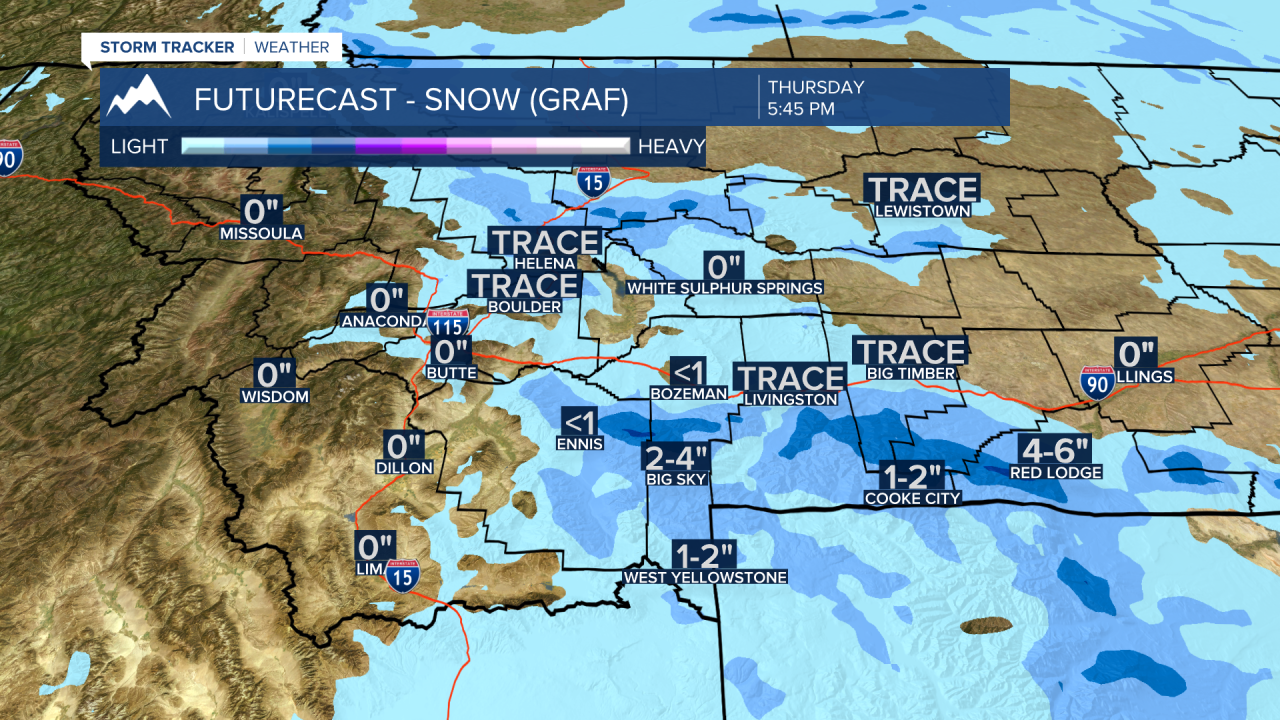
The next shot of snow is a very weak disturbance dropping in from the North on Wednesday night. This should bring areas of light snow mostly east of the divide for central and SW Montana counties. Mountain passes could see an inch or two, but most lower valleys should see a dusting to 1 inch of snow by Thursday morning. Even though this storm is not expected to produce significant snow, the light snow will create more wintry travel conditions for your Thursday morning commute.
By the weekend the forecast is warming up above normal with lower 40’s likely for lower valleys and improving travel weather.
The next weather maker will arrive Monday into Tuesday with increasing snow, turning colder, and possible below zero wind chills.
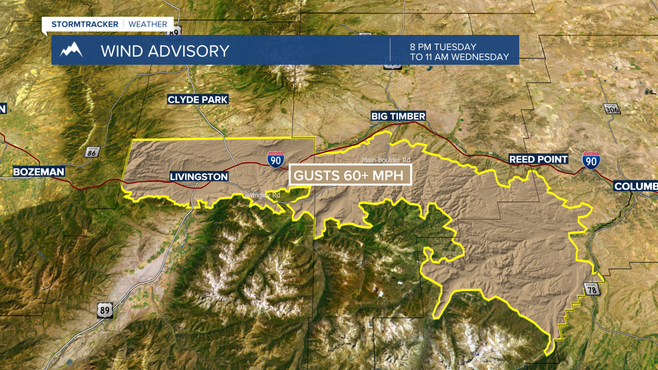
The National Weather Service has issued a WIND ADVISORY for the Livingston area from 8 pm Tuesday to 11 am Wednesday. Peak wind gusts up to or over 60 mph are possible. Watch for areas of blowing snow.