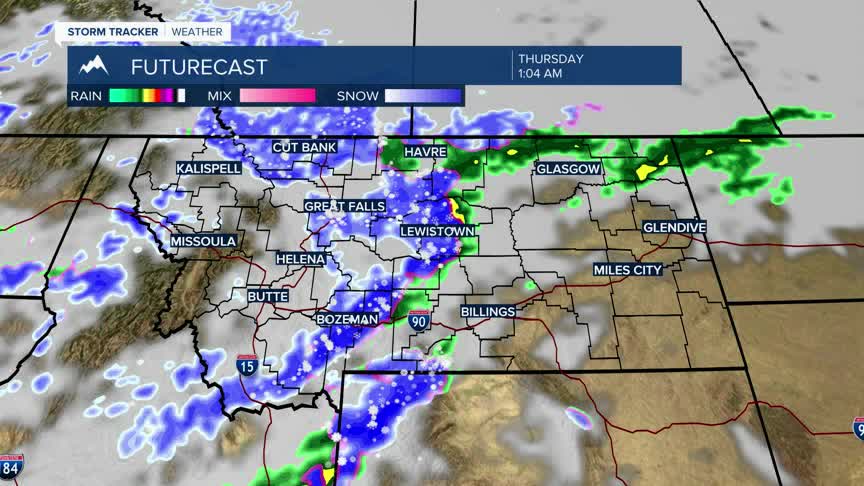


BOZEMAN – A colder and unsettled weather pattern will continue through the rest of this week with the next storm system arriving Wednesday evening into Thursday morning.
This next system could bring snow even down to the valley floor by Thursday morning. Widespread mountain snow is likely and thus you should expect wintry travel conditions over mountain passes across the state.
Temperatures will fall well below normal Thursday into Friday behind the next cold front with highs in the 30s and lows down into the teens.
By the weekend this storm will be exiting the region with a warming and drying trend that could last into early next week but there will be more storms next week with another round of mountain snow.
