


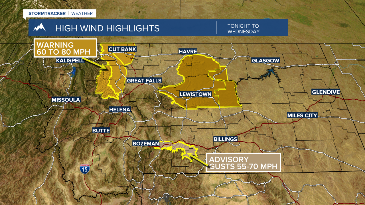
BOZEMAN – A Pacific cold front will pass through tonight into Wednesday morning producing areas of light snow and stronger surface wind gusts.
That combination will create areas of blowing snow and low visibility travel hazards especially for those mountain passes with snow on the ground like Monida Pass, Raynolds Pass up into the Ennis area.
The National Weather Service did issue a WINTER WEATHER ADVISORY for areas west of the divide including the Butte, Anaconda, Deer Lodge, and MacDonald Pass areas.
General snow totals should be light around 1”-3” but combined with peak wind gusts up to 45 mph will create blowing snow and low visibility travel hazards.

The general wind forecast over SW Montana will be W to SW winds 15 to 25 mph and gusts 30 to 50 mph at times tonight through Wednesday afternoon.
Temperatures will be slightly cooler behind the front Wednesday into Thursday before moderating again by the end of the week into the weekend.
