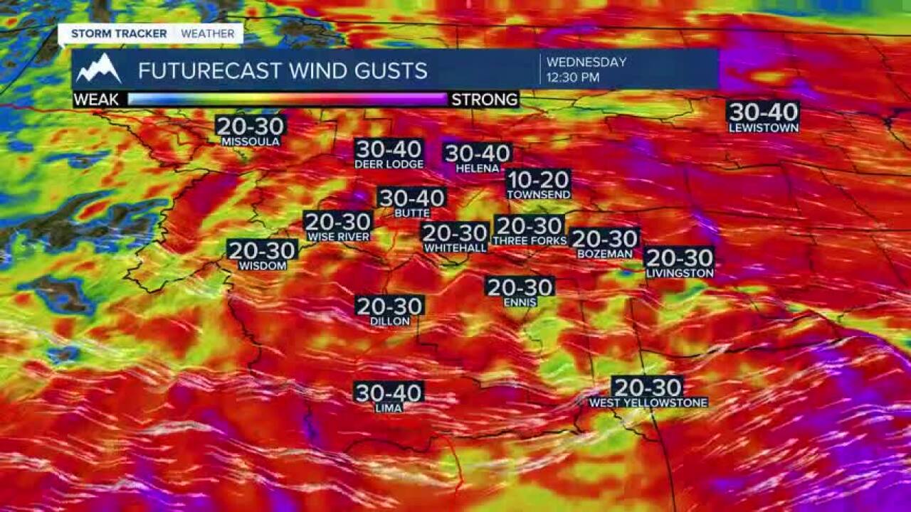


Today's Forecast: Wednesday will be substantially cooler with scattered rain showers and gusty winds.Highs will top out in the low 50s for the afternoon as scattered showers drive through the region starting mid-morning through the evening. Gusty winds will dominate the day with west to northwest wind between 15-30 mph with peak gusts near 40 mph. Showers are expected to continue through midnight. Skies are expected to clear overnight which could bring patchy frost by early Thursday morning in the region.

BOZEMAN: High: 53; Low: 40. Cool showers are expected across the area with winds gusting between 20-30 mph out of the west to northwest.A few of those showers could also bring isolated weak thunderstorms. Look for the gustiest winds to pick up by noon through the early evening.Spotty showers will continue tonight with mountain snow showers possible.
BUTTE: High: 49; Low: 35. Not much fluctuation with temperatures is expected for Wednesday as scattered showers and gusty northwest winds push through the region through the day.Showers will be scattered with pockets of moderate rain possible.A few of those showers may bring a little lightning and thunder.Look for winds out of the northwest between 15-30 mph and gust approaching 35 mph at times through sunset. Patchy frost is possible by early Thursday morning.
DILLON: High: 54; Low: 36. A few spotty showers are possible today through the early afternoon otherwise we are looking at mostly sunny conditions.Gusty west to northwest winds are possible between 15-30 mph. Look for a crisp overnight with lows in the middle 30s.Some low-lying areas could see a light frost.
WEST YELLOWSTONE: High: 54; Low: 27. A couple of spotty light showers are possible through the morning with rain and mountain flakes possible through the afternoon and evening.Winds will pick up from the west to southwest between 15-30 mph through the day and saying in the 15-25 mph range through sunset.
WARMER FOR THE END OF THE WEEK: While a slight warm-up is moving in for Thursday and Friday leaving highs in the 60s and 70s, another cool-down is expected for the weekend.A cold front will bring showers back to the area through the day on Saturday with highs in the 50s to low 60s in the region.We should also expect scattered rain showers for the valleys and high mountain snow showers possible during the coolest parts of the day.Highs will build back to the 70s and 80s early next week and will hopefully bring us more stable weather to get out and enjoy.
