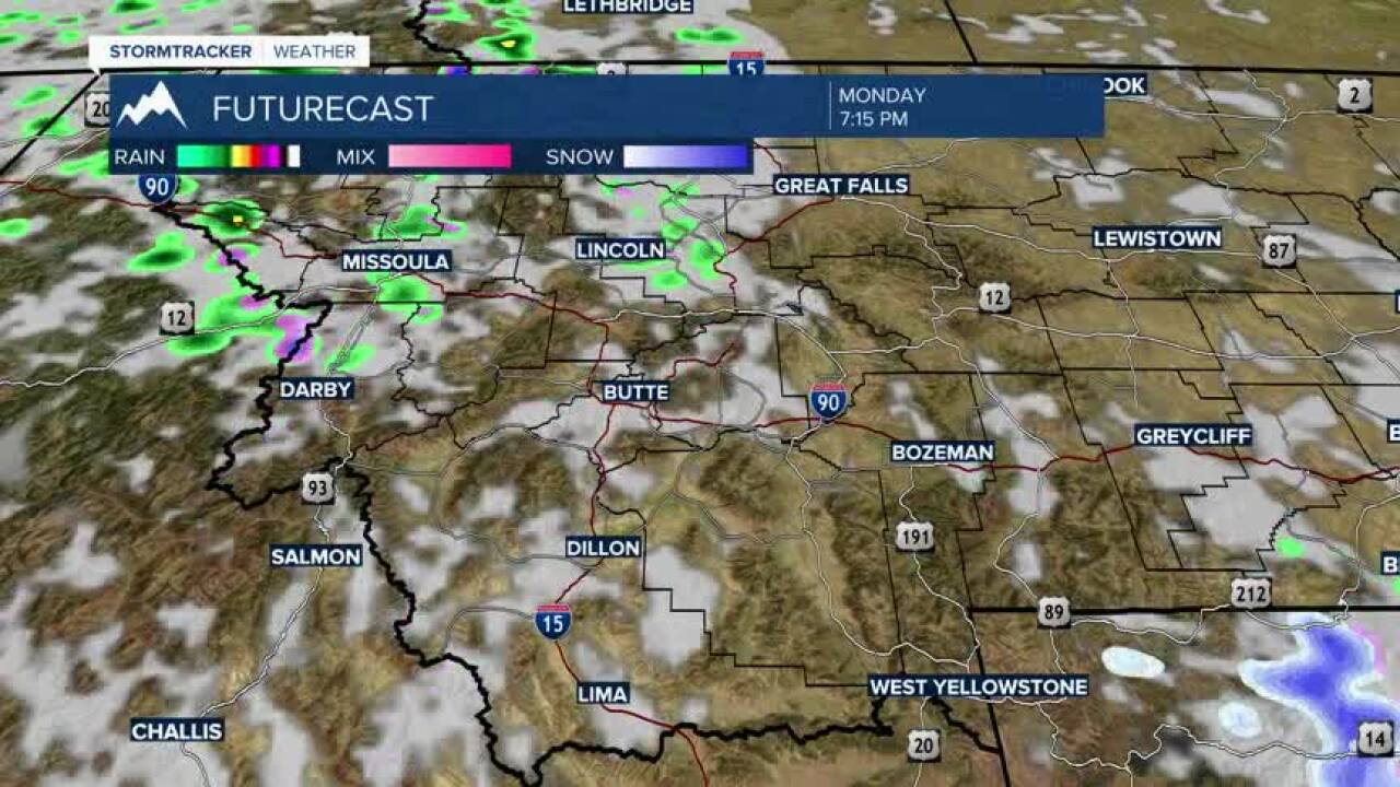


Today's Forecast: Chilly temperatures will stick around for your Monday with a few isolated snowflakes in the morning, primarily east of the continental divide.Those showers will give way to more sun late in the afternoon with highs in the upper 40s and low 50s.Clear skies for the evening are expected to bring a hard freeze to the region with lows in the 20s by early Tuesday morning.Look for a north wind between 5-15 mph.
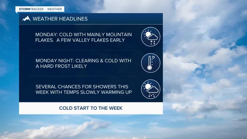
BOZEMAN: High: 47; Low: 28. A few spotty snowflakes are possible for your Monday morning.There are some isolated chances for a few rain showers in the afternoon as we see highs in the upper 40s.Look for clearing skies tonight that will allow lows to fall into the 20s and could bring a hard freeze to the region.Winds will stay primarily out of the north between 5-15 mph.
BUTTE: High: 50; Low: 27. Mostly cloudy skies to start with a more sunshine expected for the afternoon. With clear skies tonight, you can expect a hard frost to set in by early Tuesday.
DILLON: High: 52; Low: 28. Partly cloudy skies will help push temperatures to near 50°. Winds will be out of the west to northwest between 5-15 mph.
WEST YELLOWSTONE: High: 43; Low: 18. A few spotty flurries are possible early with a spotty rain shower possible during the afternoon before skies clear tonight allowing lows to fall to the teens.
UP AND DOWN TEMPERATURES THIS WEEK
This week will be up and down with our temperatures through late week.Highs will typically stay below average through Thursday with several systems rolling into the region that could bring area showers and the chance of a few scattered snowflakes again on Thursday.
Memorial Day weekend is expected to warm nicely into the 60s and 70s with plenty of sunshine.Monday is expected to be clear and warm as well with highs well into the 70s.
Another round of showers could move in as early as Tuesday with weather models indicating at the very least high-elevation snow.
