


Today's Forecast:
Southwest Montana will see a cool and mostly dry start to the day with sunshine gradually mixing with increasing afternoon clouds. Winds will become breezy this afternoon across many valleys, and isolated showers may begin developing late tonight ahead of a more active weather pattern arriving later this week. Elevated fire danger remains limited today, although gusty afternoon winds could still create localized concerns in areas with dry fuels.
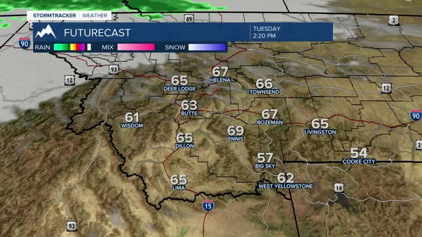
BOZEMAN: High: 69; Low: 38. Mostly sunny skies today with increasing clouds developing later this afternoon and evening. West northwest winds increase to around 10 to 20 mph with occasional higher gusts possible this afternoon. Dry conditions continue through most of tonight before a slight chance of showers develops late overnight.
BUTTE: High: 68; Low: 35. Partly sunny skies with breezy afternoon conditions expected today. Northwest winds increase between 5 and 15 mph with gusts approaching 25 mph at times. Mostly dry weather continues through tonight with clouds gradually increasing overnight ahead of late-week rain chances.
DILLON: High: 72; Low: 38. Sunny to partly sunny skies today with breezy west winds between 15 and 25 mph this afternoon. Dry conditions continue through tonight with increasing clouds arriving late. Overnight temperatures cool into the upper 30s under partly cloudy skies.
WEST YELLOWSTONE: High: 65; Low: 29. Mostly sunny skies today with cool temperatures continuing across the region. Southwest winds increase between 10 and 20 mph this afternoon with occasional gusts above 25 mph possible. Clouds gradually increase tonight with a slight chance of showers developing late overnight.
RAINY TO WRAP UP THE WEEK
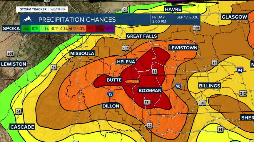
A much more active weather pattern arrives beginning Thursday evening and continuing through Saturday across southwest Montana. Widespread shower chances increase Thursday night with periods of rain and scattered mountain thunderstorms expected at times through the weekend. Cooler temperatures, increasing cloud cover and periods of rainfall are expected Friday and Saturday, with some higher elevations potentially seeing the season’s first accumulating mountain snow. While fire danger concerns may briefly increase during breezy periods ahead of the system, the wetter and cooler pattern late week into the weekend should provide improving humidity and reduced fire weather concerns across much of the region.
