


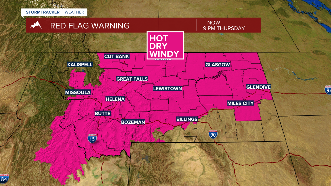
BOZEMAN – Hot, dry, and windy weather is creating very high to extreme fire danger over SW Montana Thursday afternoon and early evening.
A RED FLAG WARNING is in effect for all of SW Montana with wind gusts over 20 mph, temperatures in the upper 80s to upper 90s, and relative humidity below 15% will create critical fire weather conditions. This means small fires can grow quickly out of control and this also means human caused fires are a huge concern with this pattern.
There could be a few isolated thunderstorms mainly over the far southern half of SW Montana Thursday afternoon. Mostly cloudy skies and areas of smoke will also develop locally through Friday afternoon.
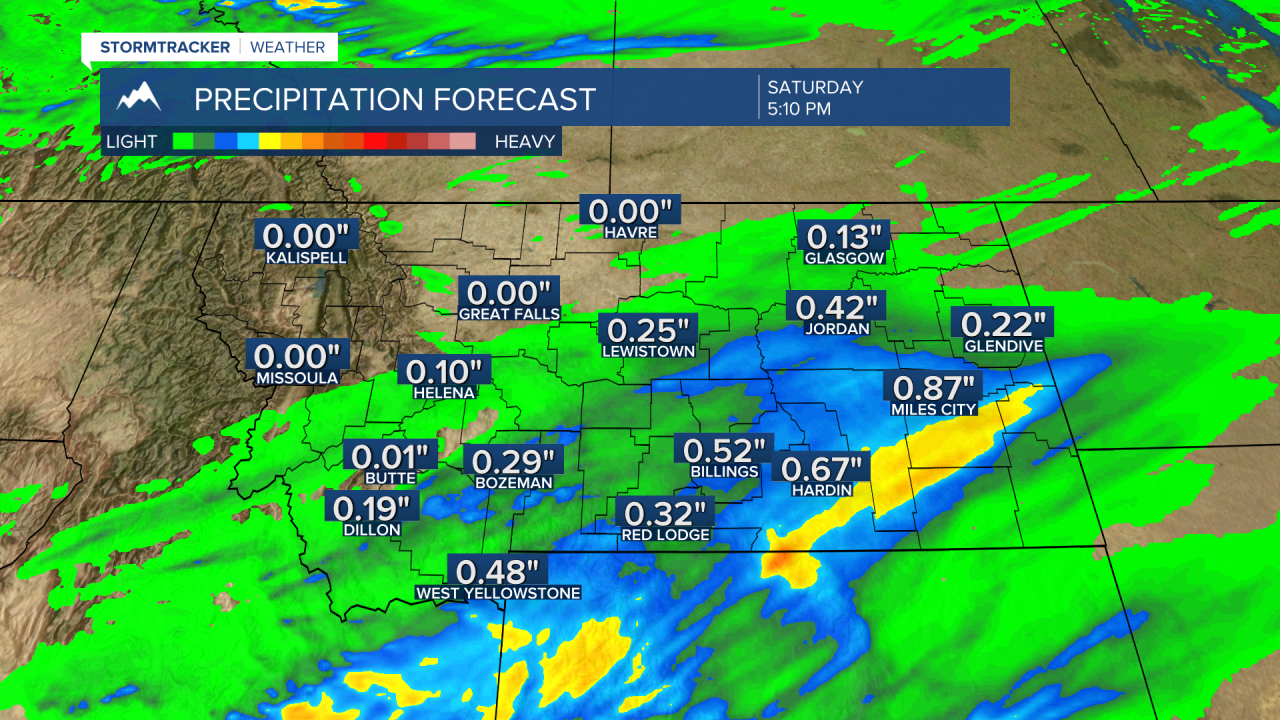
A cold front will produce scattered showers and thunderstorms Friday night into Saturday morning. East of the divide could see some good moisture around a quarter to a half an inch, especially from Bozeman to West Yellowstone to Billings.

Temperatures will be much cooler Saturday with this system as well but that should be very short-lived as a rapid warm up begins Sunday and we could be back up into the low to mid 90s by Tuesday of next week.
