

BOZEMAN – A slow moving area of Low Pressure will impact most of Montana through the end of the week. Colder air, rain changing to snow, and locally windy conditions is in the general forecast.
Just like the last storm snow is possible at all levels Thursday into Friday. This could bring wintry travel conditions with slushy covered road that can become icy by Thursday night into Friday morning.
The National Weather Service has issued a WINTER WEATHER ADVISORY for most of SW Montana Wednesday night through Thursday night. This includes Butte, Anaconda, Deer Lodge areas along with Bozeman Pass, Monida Pass, Elk Park, Boulder Hill, MacDonald Pass.
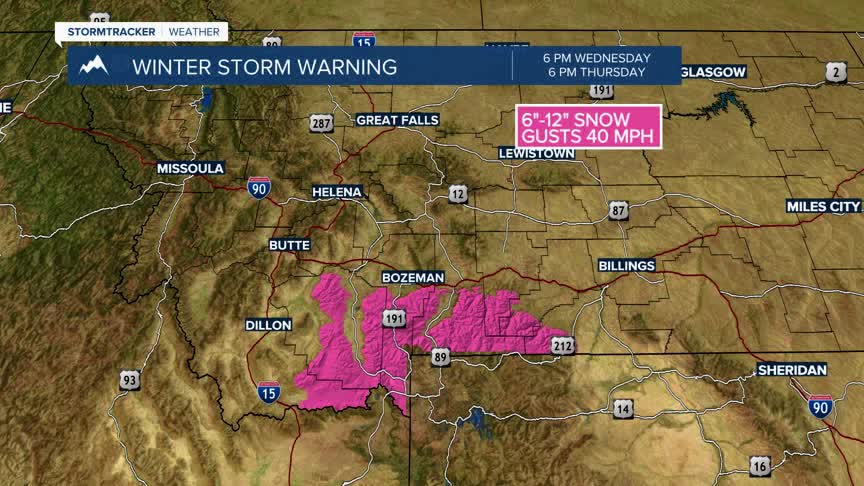
The National Weather Service issued a WINTER STORM WARNING for the Madison, Gallatin, Absaroka-Beartooth ranges. Up to or over a foot of heavy wet snow is possible from Wednesday night through Friday evening.
The National Weather Service as of 1 pm Wednesday continues a Winter Storm Watch for the Gallatin Valley. This watch means conditions look favorable for snow Thursday afternoon through Friday afternoon with possibly 2”-8” of valley snow possible.
The National Weather Service has a HIGH WIND WARNING up for the Dillon to Whitehall region, Whitehall to Three Forks and down through the Ennis region. Peak wind gusts up to 60 mph are possible through 6 pm Wednesday.
