


Today's Forecast:
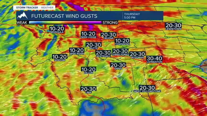
Southwest Montana will enjoy a warm, breezy and mostly dry day with plenty of sunshine and a few passing clouds. Gusty southwest winds will pick up this afternoon, especially in open valleys and along the Continental Divide, creating elevated fire danger concerns in some areas.
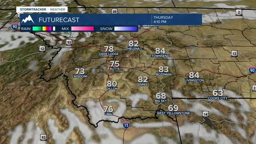
BOZEMAN: High: 82; Low: 47. A bright and comfortable day with mostly sunny skies and a breezy afternoon. Southwest winds increase to 15 to 25 mph with occasional gusts over 30 mph. Mild this evening with partly cloudy skies overnight.
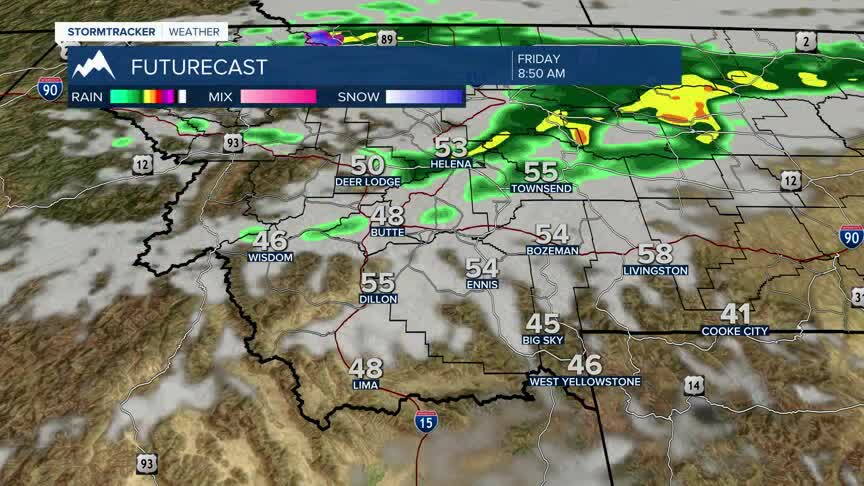
BUTTE: High: 78; Low: 44. Mostly sunny and breezy today with dry conditions expected through tonight. Southwest winds increase to 15 to 25 mph this afternoon before gradually easing overnight. A cool and quiet night ahead though we could see a shower by dawn Friday firing through the area.
DILLON: High: 82; Low: 48. Sunny to partly cloudy with warm afternoon temperatures and gusty southwest winds developing later today. Winds may gust between 25 and 35 mph at times this afternoon. Mild this evening with partly cloudy skies overnight.
WEST YELLOWSTONE: High: 71; Low: 37. A cool but pleasant day with a mix of sunshine and passing clouds. Breezy southwest winds gust between 25 and 35 mph this afternoon, especially near open terrain and mountain passes. Chilly tonight with partly cloudy skies.
ELEVATED FIRE DANGER BUT TURNING COOLER:
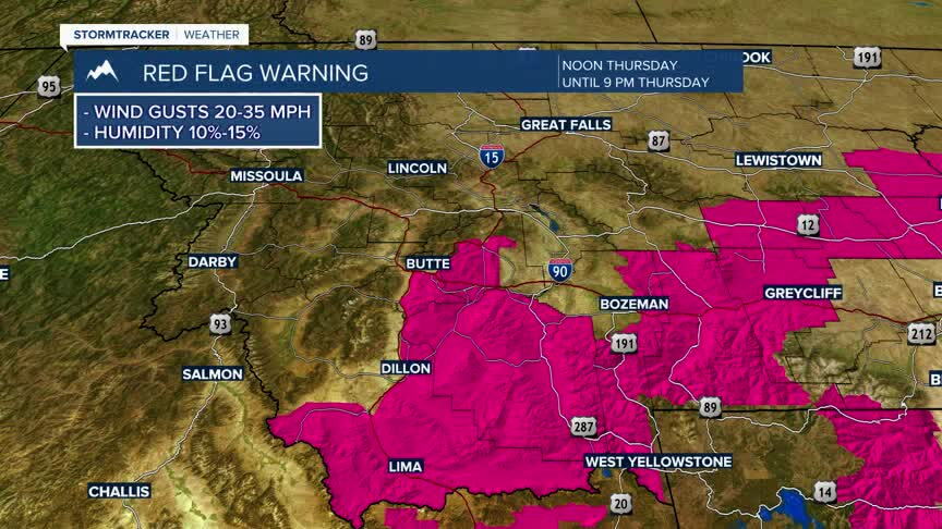
Fire danger will increase Thursday across southwest Montana as dry air, warm temperatures and gusty southwest winds combine during the afternoon and evening hours. Outdoor burning is discouraged, and any fire could spread quickly in dry grasses and brush.
Most of southwest Montana stays dry through tonight, though a few light showers may brush northern areas early tomorrow morning. By Friday afternoon and evening, scattered showers are expected to develop across parts of the region as a cooler weather pattern slowly begins to move in.
A much bigger temperature shift arrives this weekend. High temperatures will fall noticeably from the 80s into the 50s and 60s by Sunday, with widespread rain developing and accumulating snow becoming increasingly likely in the higher mountains above pass level late Sunday into Monday.
