BOZEMAN – A very hot and mostly dry pattern is setting up Friday through Monday over most of Montana and across the entire region. Temperatures could reach the low to mid 90’s with a few upper 90’s locally.
Please be extremely careful with all outdoor activities this weekend with the extreme heat and try not to overexert yourself during the hottest times of the day.
The other minor issue that we are watching is for isolated mostly dry thunderstorms to develop Friday afternoon over SW Montana mostly over surrounding mountain ranges. This could prompt a red flag warning Friday afternoon, look for updates Friday morning with Matt Elwell.
A Red Flag Warning has been issued for the Salmon, ID area with the possibility for isolated dry thunderstorms over central Idaho through 10 pm Thursday night.

Most of the Pacific NW is dealing with triple digit heat again today and there are widespread heat advisories and excessive heat warnings for that region through Saturday evening.
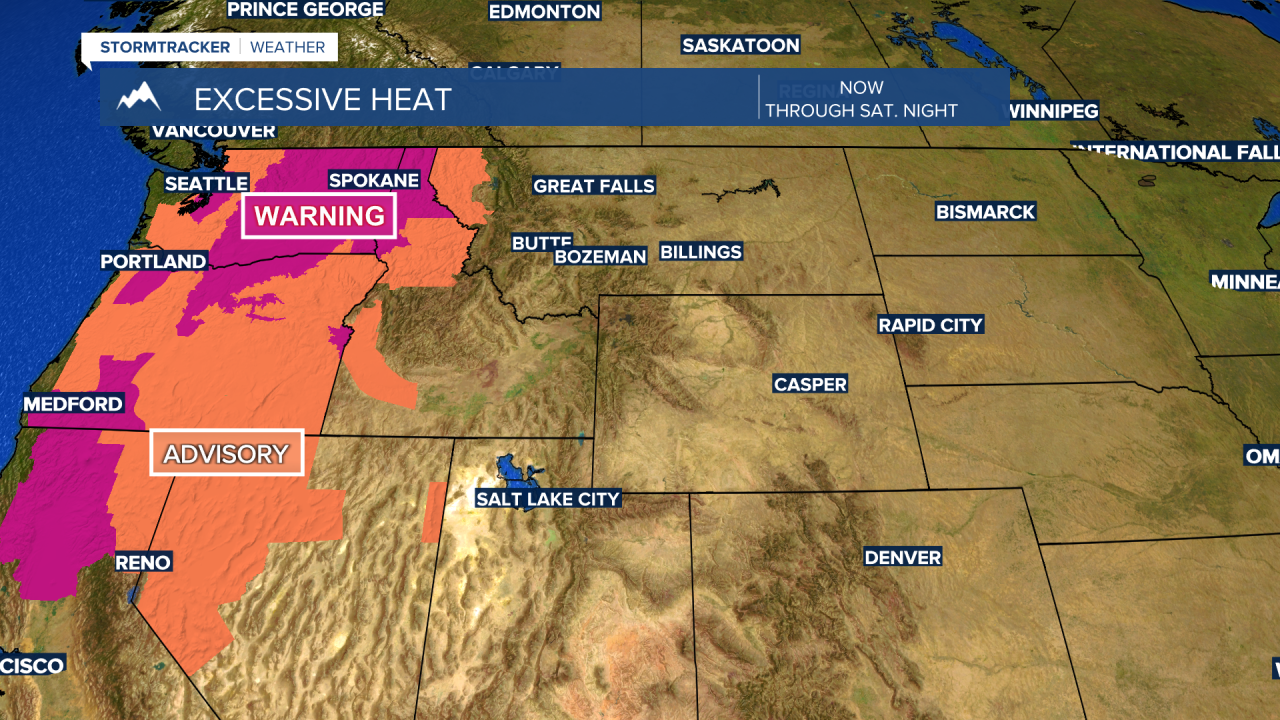
Far western and NW counties of Montana area also now under a Heat Advisory through midnight Sunday with temperatures forecast to reach the 95 to 105 degree range.

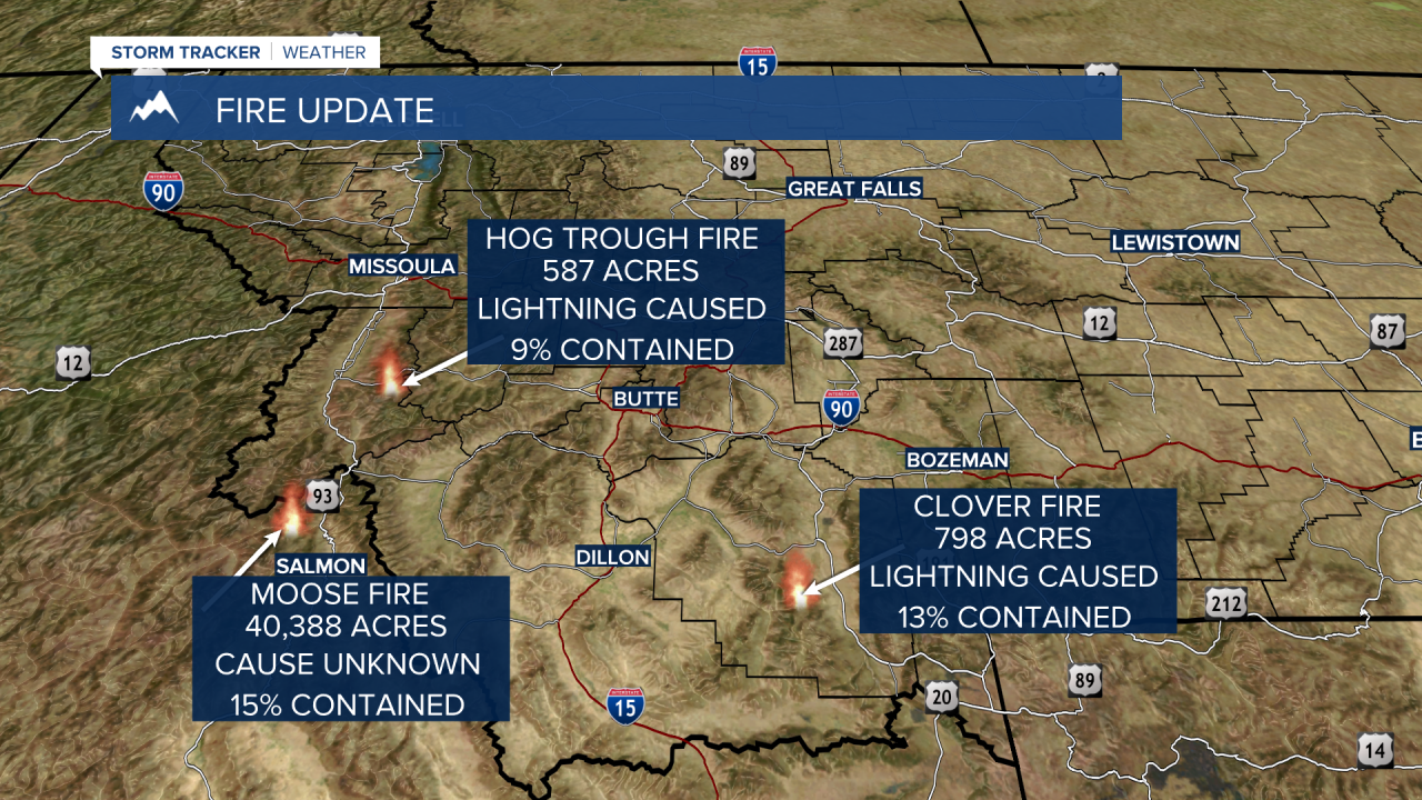
Thursday fire update starting with the largest fire in our region the Moose Fire north of Salmon, ID. This fire is now burned over 40,000 acres and is only 15% contained. The Hog Trough Fire report has not changed in days, so the latest information is the same as yesterday at 587 acres. The Clover Fire burning in the Gravelly Range south of Ennis has grown to almost 800 acres and is 13% contained.