UPDATE — 10:07am August 20 — The Bivens Creek Fire remains at 2,267 acres; this is the higher priority fire because of nearby residences; crews are building hand lines, applying retardant and bringing engines and heavy equipment to reinforce lines. Forest Service lands in the area are closed and a temporary flight restriction is in place; officials warned that drones or private aircraft can halt air operations and endanger firefighters.
The Cloudrest Fire still stands at 1,190 acres; hotshot and engine crews built anchor points and hand lines and are working access and structure protection. Both fires are at 0% containment.
A Red Flag Warning is in effect Wednesday from 1PM to 10PM; hot, dry conditions and instability could produce active burning and large smoke columns. Winds are expected to shift from the southwest to the northeast about 8PM, which could push fire and smoke into new areas on the west side of the Tobacco Roots. See airnow.gov/wildfires for air-quality updates.
A community meeting will be held tomorrow Thursday August 21 at 7pm at the Ennis Assembly of God in Ennis, MT.
Photos below: Spike Camp Location and Drop Off for Crews Supporting the Cloudrest Fire on August 19, 2025. Thirty fire fighters will be spiked out there for 5-7 days.


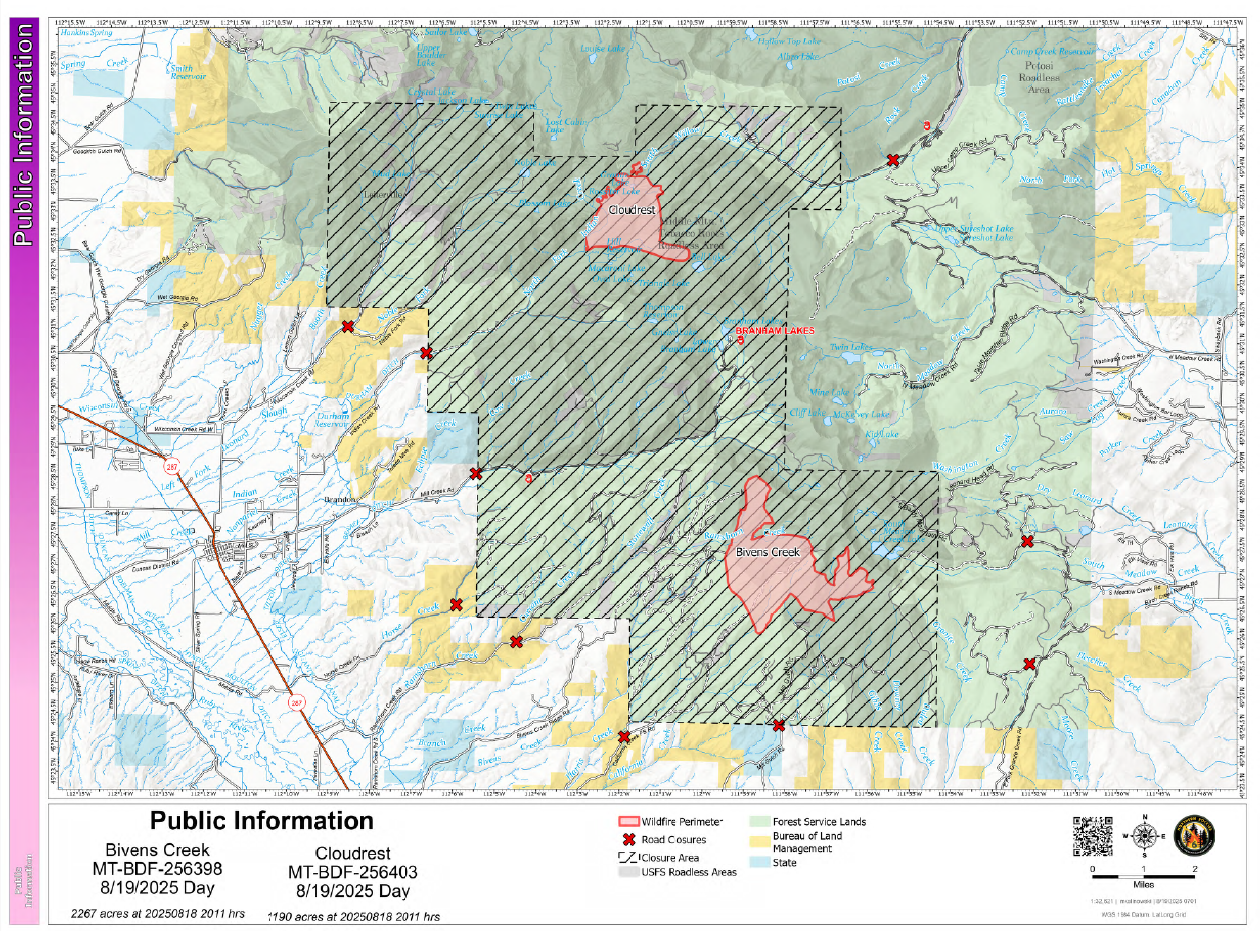
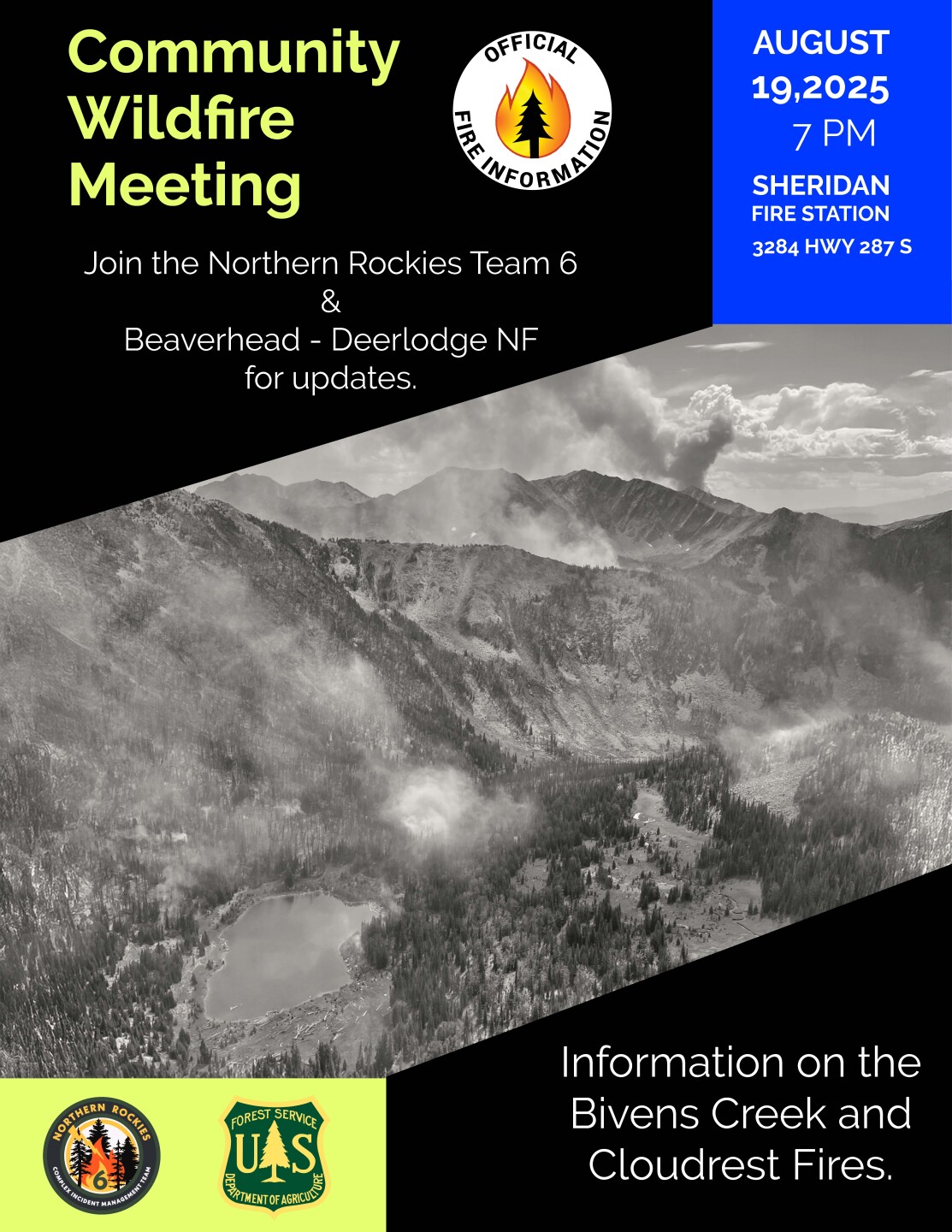
UPDATE — 10:15am August 19 — The Bivens Creek Fire has grown to 2,267 acres; the Cloudrest Fire stands at 1,190 acres. A Community Wildfire Meeting will be held tonight at 7 PM at the Sheridan Fire Station located on Highway 287 South in Sheridan.
Fire managers are taking direct action along the fire lines, with increased activity expected due to warm and dry weather. The Bivens Creek Fire may expand eastward, potentially impacting nearby communities including Pony, Harrison, and Bozeman. In response, hotshot crews will be deployed for 4-5 days to build containment lines and protect local watersheds, with efforts underway to establish secondary lines using existing road systems.
For public safety, area closures on Forest Service lands have been enacted; please respect all barriers and closures. For smoke and air quality updates, visit www.airnow.gov/wildfires.
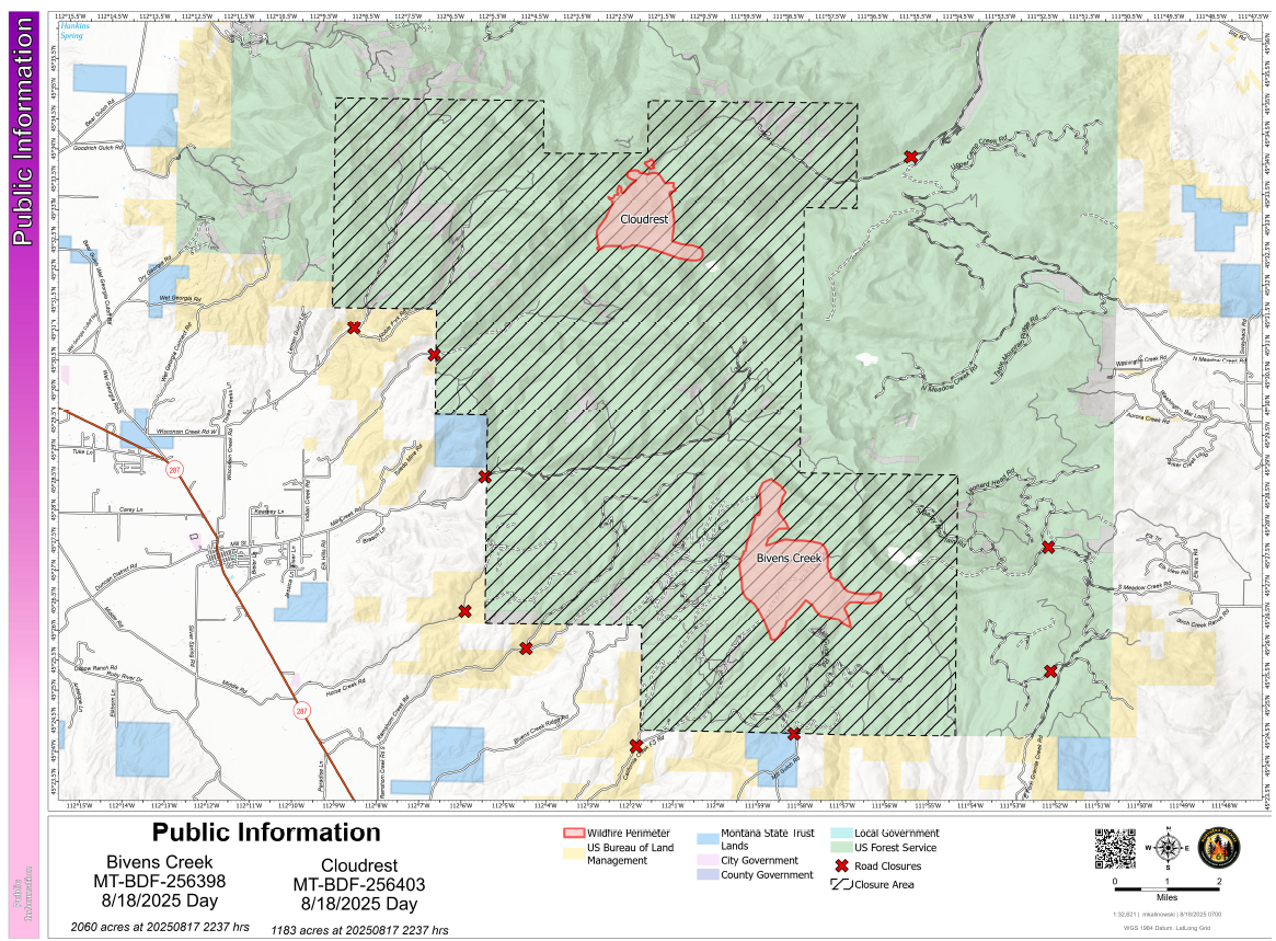
UPDATE — 5:10pm August 18 — The Bivens Creek fire is at 2,059.5 acres; Cloudrest is at 1,182.8 acres. Both at 0% containment.
The Bivens Creek and Cloudrest Fires remain active; The Bivens Creek Fire is at 1,932 acres, and the Cloudrest Fire is at 1,156 acres.
The Northern Rockies Complex Incident Management Team 6 assumed control of both fires on August 17, bringing additional resources for full suppression efforts.
Weather conditions contributed to reduced fire activity over the weekend, but warmer temperatures and lower humidity are expected today. Increased smoke may impact nearby communities, including Pony, Harrison, and Bozeman. Residents can find air quality updates at www.airnow.gov/wildfires.
Road closures are in effect for public and firefighter safety. A Temporary Flight Restriction (TFR) is also in place, prohibiting drones and private aircraft in the area to ensure safe firefighting operations.
Cloudrest Fire: Despite slight growth, the fire remains in a high-altitude area. Crews will establish direct firelines on the north and west edges, focusing on protecting the Indian Creek watershed.
Bivens Creek Fire: The fire is advancing eastward and may rapidly grow in the coming days. Direct lines will be constructed on the western flank to protect surrounding structures.