


The Trail Ridge Fire southeast of Sula has grown to 10,874 acres and is 0% contained.
According to the Wednesday update, the blaze "continues to grow on all sides of the fire."
Most of the growth has been seen moving to the east within the 2000 Mussigbrod Burn Area.
Fire managers note that "rapid growth and hazardous conditions exist and are being assessed by firefighters in the area for containment options."
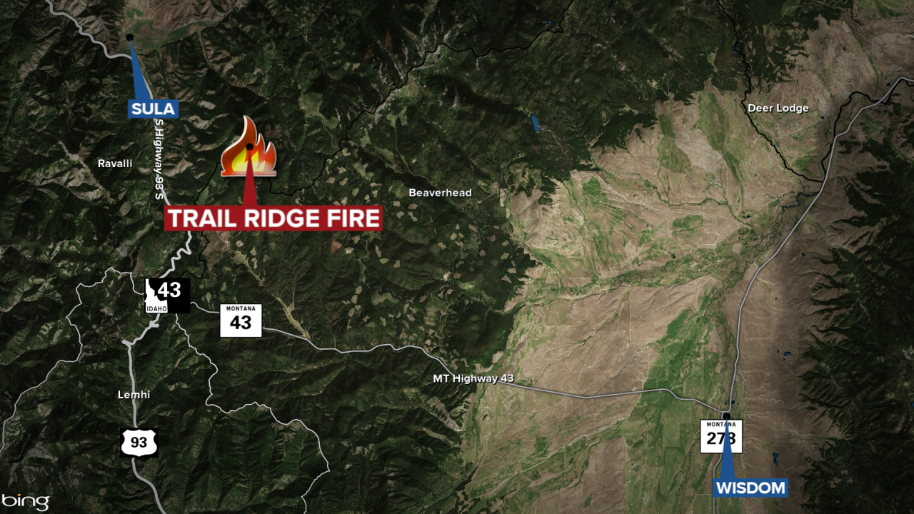
The Trail Ridge Fire is burning approximately five miles southeast of Sula and approximately 11 miles northwest of the Big Hole National Battlefield.
Meanwhile, the 85-acre Thompson Creek Fire saw two small containment breaks on Wednesday that crews and a helicopter were able to secure.
Both fires are located near the Continental Divide Trail.
A public meeting to discuss the two fires has been scheduled for 7 p.m. on Thursday at the Springer Community Clubhouse in Sula.
There are closures in effect in the Bitterroot National Forest and the Beaverhead-Deerlodge National Forest due to the two fires.
