

BOZEMAN – A very chilly morning for SW Montana with clear skies last night. The good news is temperatures will be rising over the next 3 days with possible 60s again by Saturday.
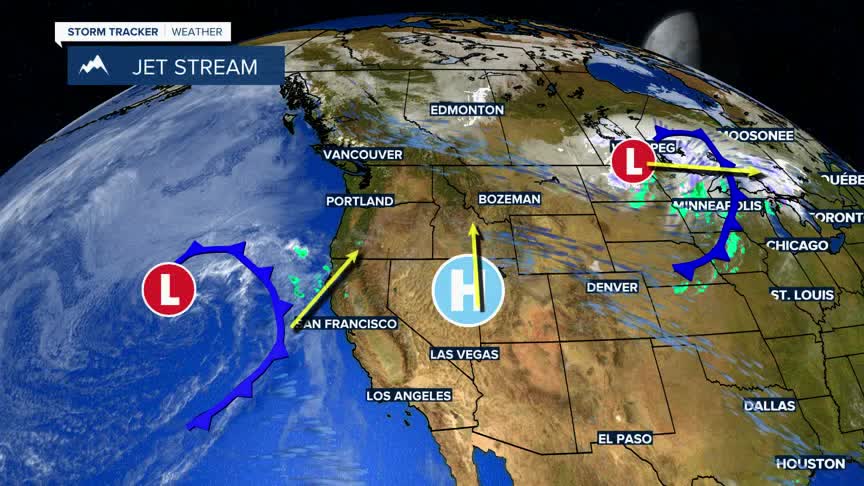
The next weather maker for us is currently sitting off the California coast, stalled at the moment.Between that storm system and Montana is a High pressure ridge. This ridge will lock us into a dry and mild pattern through Saturday.
Saturday afternoon there could be just enough moisture lifting into Montana from that California storm system to produce a few isolated thunderstorms Saturday with a better chance for late showers and thunderstorms on Sunday.
The area of Low pressure will spin up into the region Monday with scattered rain or snow showers and cooler temperatures early next week.
