


Today's Forecast:
Southwest Montana will see another warm and smoky day with hazy sunshine across much of the region. Air quality concerns continue due to lingering wildfire smoke, especially during the morning hours in the valleys. Winds will become breezy this afternoon between 10 and 20 mph at times, and a few isolated showers and thunderstorms may develop later today, mainly near the mountains and Yellowstone region.
BOZEMAN: High: 82; Low: 50 Patchy smoke and hazy skies this morning with gradual clearing through the afternoon. Northwest winds increase to around 10 to 15 mph later today. A slight chance of showers and thunderstorms develops this evening before skies remain mostly cloudy overnight with lingering smoke possible.
BUTTE: High: 79; Low: 48 Areas of smoke this morning followed by partly sunny skies this afternoon. A few isolated showers and thunderstorms are possible after 3 PM. North to northeast winds increase between 10 and 15 mph with occasional higher gusts this evening. Smoke and haze continue tonight with a lingering chance of showers early.
DILLON: High: 83; Low: 50 Widespread smoke early with skies becoming mostly sunny this afternoon. South to southeast winds increase to around 10 to 15 mph during the afternoon hours. Dry weather is expected for most locations today with patchy smoke lingering tonight under mostly cloudy skies.
WEST YELLOWSTONE: High: 76; Low: 40. Patchy smoke this morning with mostly sunny skies developing this afternoon. A chance of showers and thunderstorms arrives after 5 PM. Southwest winds increase between 10 and 20 mph with gusts over 20 mph possible at times. Cooler conditions settle in tonight with lingering evening showers possible.
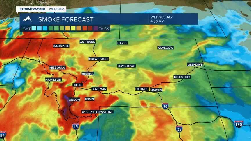
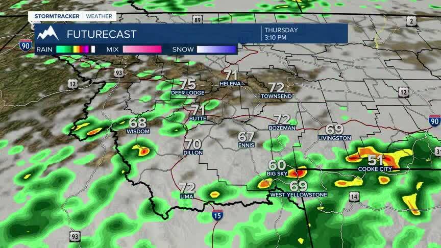
RAIN CHANCES AND COOLER LATE THIS WEEK A major pattern change arrives late this week as cooler temperatures and increasing moisture spread across southwest Montana. Widespread chances for showers and thunderstorms develop Thursday through Saturday, with locally heavy rainfall possible at times. Fire danger and smoke concerns remain elevated today, but improving humidity and cooler weather later this week may help improve air quality and reduce critical fire weather conditions.
