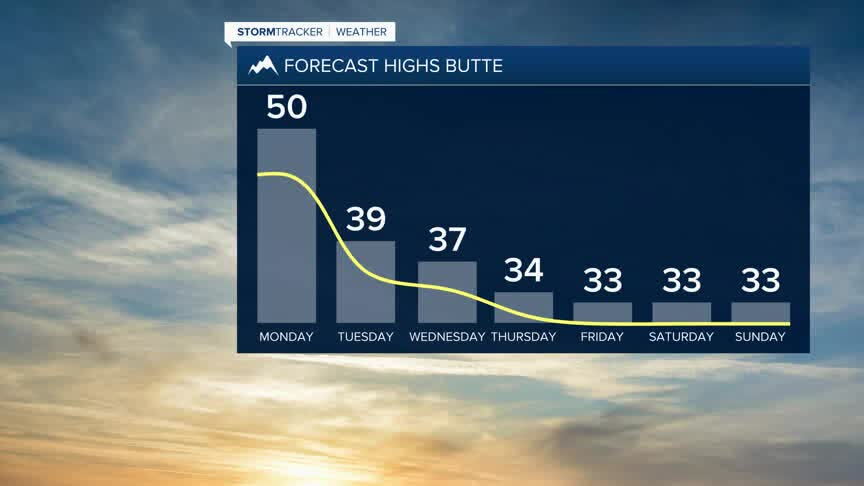
Today's Forecast:
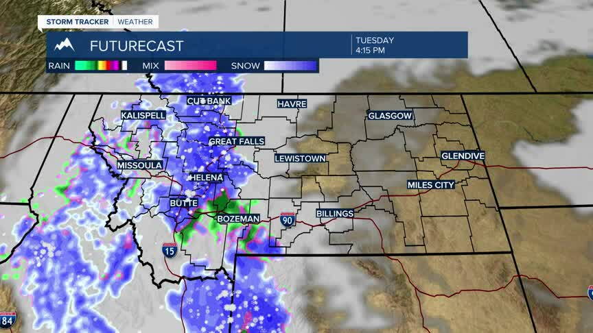
Monday will be the last mild and mainly dry day before a much more active weather pattern arrives. Temperatures remain above normal with breezy conditions at times. A Pacific system moves into the region tonight, bringing widespread precipitation and significantly colder temperatures Tuesday into Wednesday. Snow begins first in the mountains before spreading into Southwest Montana valleys as snow levels fall Tuesday.
BOZEMAN:
High: 54; Low: 38. Mostly cloudy and mild today with mainly dry conditions. Clouds thicken tonight as the next weather system approaches, with precipitation chances increasing toward Tuesday.
BUTTE:
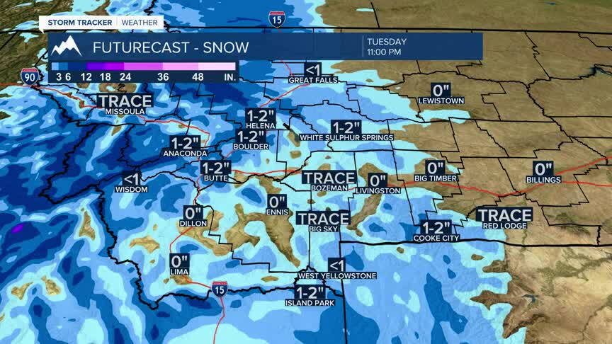
High: 50; Low: 39. Mostly cloudy and mild today. Precipitation develops tonight before colder air changes it to snow Tuesday. Snow could become moderate at times Tuesday, with plowable accumulation possible around Butte and Homestake Pass.
DILLON:
High: 49; Low: 34. Mostly cloudy and mild today before precipitation chances increase tonight. Rain and higher-elevation snow transition toward valley snow Tuesday as colder air moves into Southwest Montana.
WEST YELLOWSTONE:
High: 47; Low: 28. Mostly cloudy and mild today. Precipitation chances increase tonight, with rain and snow changing toward mainly snow as colder air settles into the region Tuesday.
WINTER WEATHER RETURNS WITH MORE CHANGES AHEAD
This is the beginning of a much different weather pattern for Southwest Montana. Widespread precipitation and much colder temperatures move in late tonight through Wednesday. Snow levels fall through Tuesday, eventually reaching Southwest Montana valleys Tuesday night into Wednesday morning.
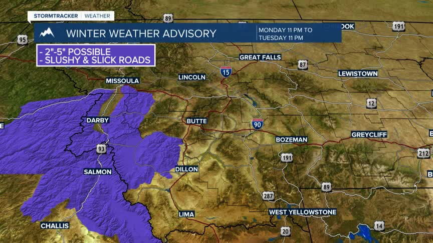
The first of several Winter Weather Advisories have been issued across the region, with plowable snow expected in parts of Southwest Montana, including around Butte and Homestake Pass. Roads may initially remain wet or slushy Tuesday, but falling temperatures Tuesday night could lead to a widespread freeze-up and areas of ice by Wednesday morning.
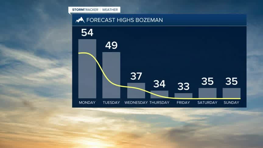
The active pattern doesn't end there. Another system is expected Thursday into Friday, keeping temperatures cooler while bringing additional accumulating mountain snow and another chance for a mix of rain and snow in the valleys.