


Today's Forecast: Expect slightly cooler temperatures and mostly cloudy skies for your Monday. Highs are expected to stay in the low to middle 70s. A few isolated t-storms are expected to develop late in the afternoon and could produce some gusty wind capable of 60 mph. Most of these showers will move out of the region by 9 PM and our skies will clear slowly overnight.

BOZEMAN: High: 71; Low: 52. Mostly cloudy skies are expected for Monday and will keep our temperatures below average by about 10 degrees. Late afternoon and early evening thunderstorms are possible with a few of those storms capable of producing gusty winds. Our wind will stay out of the southeast between 5-15 mph. Showers will fade quickly near sunset as skies clear slowly by Tuesday morning.
BUTTE: High: 72; Low: 49. Expect mostly cloudy skies for your Monday with a very slim chance of late-day showers or thunderstorms moving through the region. Those showers will fade quickly by 9 PM and our skies will clear during the overnight. Look for southeast wind between 5-15 mph.
DILLON: High: 71; Low: 52. Expect mostly cloudy skies and mild temperatures for the afternoon. A few thunderstorms are likely during the mid-afternoon. Those showers will fade quickly for the evening and leave lows in the lower 50s overnight.
WEST YELLOWSTONE: High: 73; Low: 51. Mostly cloudy skies will dominate the day and keep our daytime highs in the middle 70s. A couple of isolated thunderstorms are possible toward the evening. Those showers will clear toward sunset and allow skies to clear overnight.
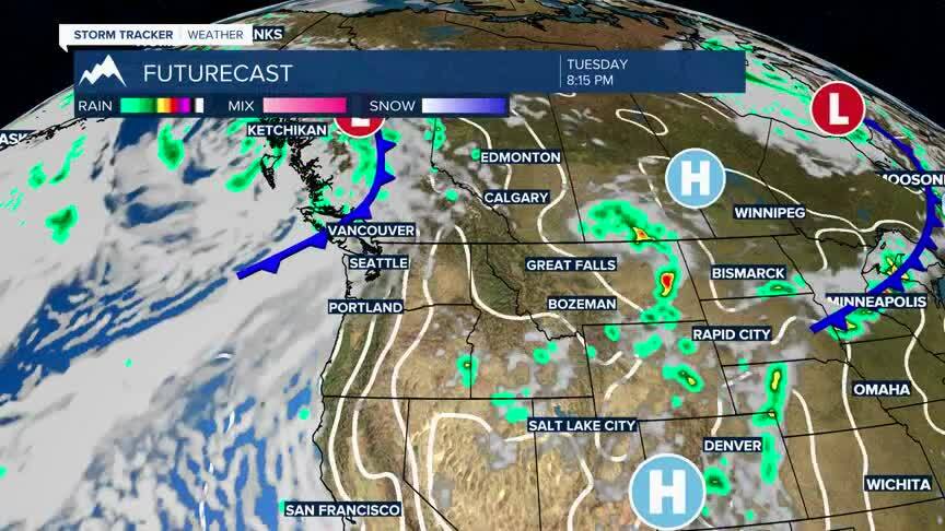
HEAT BUILDS THIS WEEK AS DRY WEATHER MOVES IN:
The current set-up for the next few days will bring a few showers and thunderstorms as our temperatures begin to climb. Once we get past Wednesday, we should expect our daytime highs to build into the middle 80s and for conditions to dry out.
Our weekend will bring the warmest temperatures of the season to the area as highs reach the low and middle 90s. We could see a couple of afternoon thunderstorms this weekend, but no significant chance is expected. With this in mind, our fire danger is expected to climb as we see these temperatures climb and our humidity drop.
