

BOZEMAN – A new Pacific storm is building off the coast of Washington State. Ahead of this storm temperatures will remain slightly above average but the wind will be increasing for most areas of SW Montana Thursday into Friday.
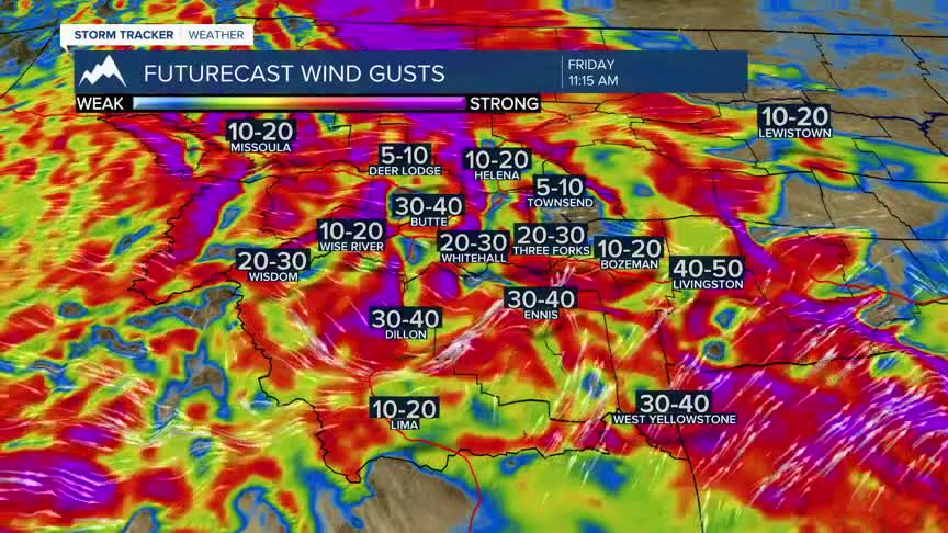
Surface wind sustained at times between 15 to 40 mph is possible across most of SW Montana Thursday into Friday with peak gusts up to 40 to 50 mph. High wind areas like Livingston could see peak gusts over 60 mph now through Thursday afternoon. In fact, there is a Wind Advisory up for the Livingston area through Thursday afternoon. Powerful cross wind along I-90 will create hazardous travel conditions for high profile vehicles.
A cold front will arrive Friday morning producing more wind along with scattered valley rain or snow and higher mountain snow.
An area of Low-pressure will drop into eastern Montana on Saturday producing a better chance for snow across the central and eastern counties of Montana with a low probability of snow for the western half of the state.
Temperatures will be cool on Saturday, but a general warming and drying trend will begin on Sunday with well above average temperatures returning to SW Montana by early next week.
