

BOZEMAN – The end is near as a slow moving upper-level trough will finally lift to the NE over the next 24 hours.
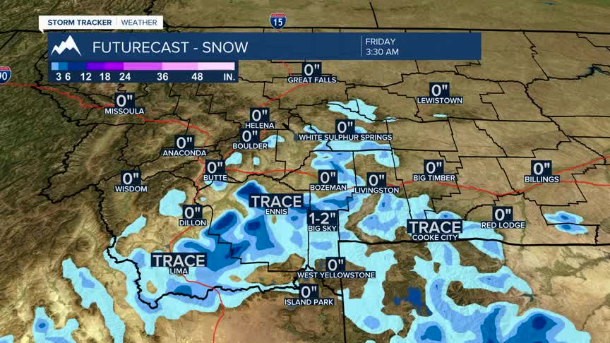
Scattered rain and snow will continue for SW Montana into Thursday as this storm system ejects to the NE. Mountain snow accumulations should be on the light side except for the highest peaks that could pick up another 3”-6”+ of snow by Friday morning.
Lower valleys should see mostly rain out of this storm system, but higher elevated valleys could see a rain/snow mix or brief periods of all snow Thursday morning.
Weak High-pressure will begin to build briefly over Montana by Friday into Saturday producing drier conditions and near normal temperatures.
