


BOZEMAN – Extreme cold again Monday morning with near record lows across SW Montana. Dillon tied your record low of –26 below zero and other reporting stations just a few degrees above record levels. Lows Monday morning varied from –19 to –52 below zero.

A viewer in Wisdom sent this picture of –52 below zero this morning.

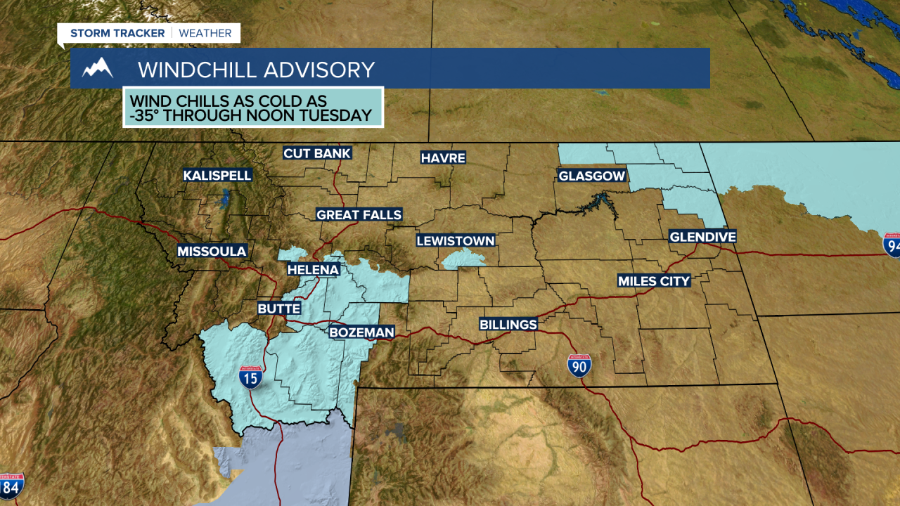
Tuesday morning will fall below zero again over SW Montana but not as cold as the last 2 nights. Lows should fall into the single digits to the teens below zero Tuesday morning and wind chill values could again be colder than –30 below zero.
For that reason, the National Weather Service did extend the Wind Chill Advisory for SW Montana through noon Tuesday.
A general warming trend begins Wednesday and by the end of the week temperatures will likely rise above freezing and could come close to 40 degrees in a few areas. This should help melt most of the thick road ice that is causing slow-go travel conditions.
