


Today's Forecast:
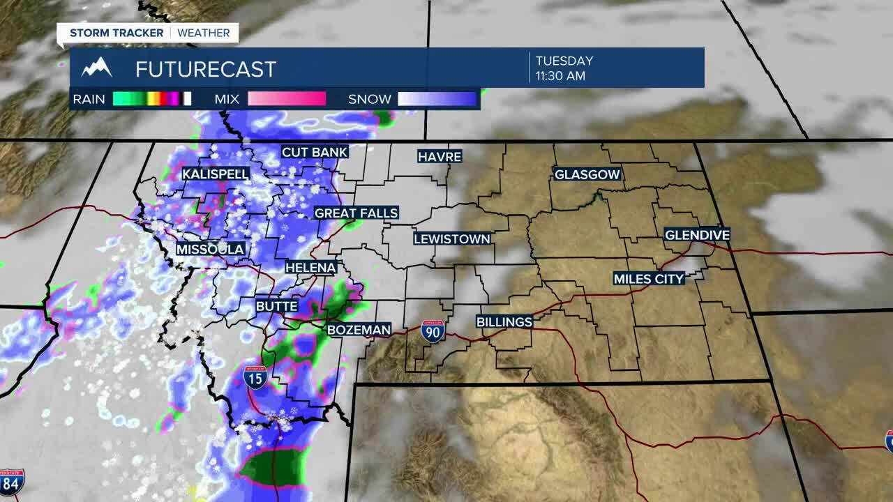
Tuesday will be a transition day across Southwest Montana. We start relatively mild and mainly dry with a few western counties seeing some mountain snow. Moisture increases through the afternoon as a weather system moves across the region. Rain becomes more widespread late today before colder air quickly changes rain to snow tonight. Valley snow will become increasingly likely as colder air moves in creating the potential for slick roads overnight and into the Wednesday morning commute.
BOZEMAN: High: 48; Low: 30.
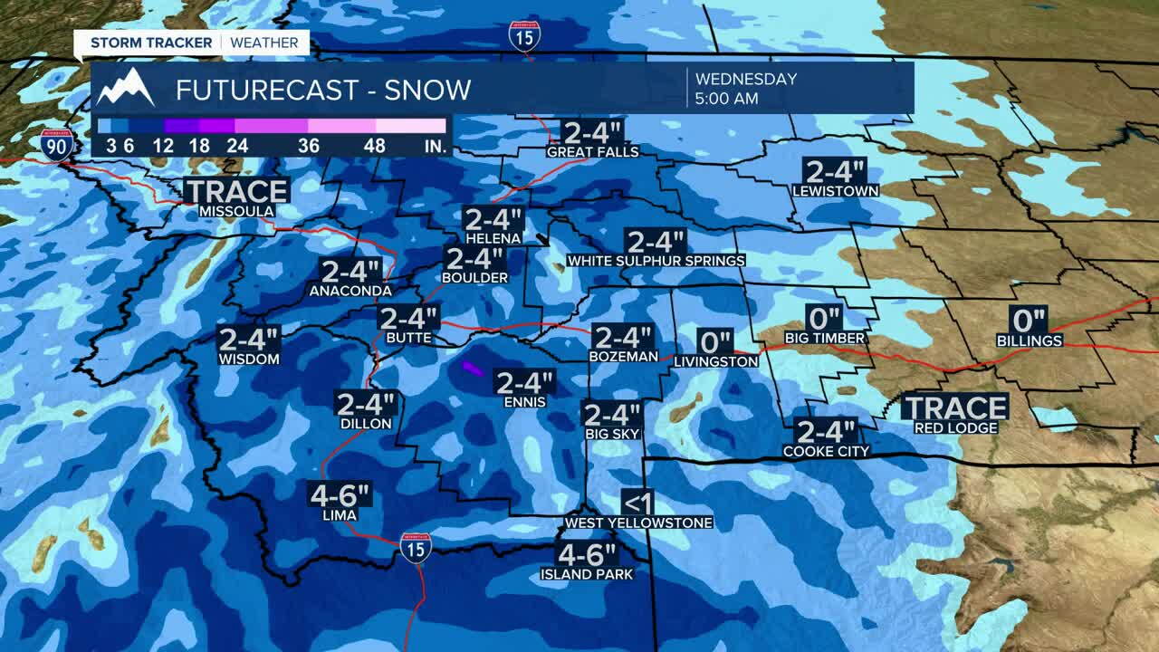
Mostly cloudy through much of Tuesday with rain becoming likely late this afternoon. Rain mixes with and changes to snow this evening, becoming all snow after about 8 p.m. Around 1 to 3 inches of accumulation is possible tonight. A Winter Weather Advisory begins at 2 p.m. and continues through 11 a.m. Wednesday.
BUTTE: High: 38; Low: 23.
Clouds increase with snow developing as colder air moves into the area. Snow could become moderate at times tonight, with accumulating snow creating slick conditions around Butte and over the higher passes.
DILLON: High: 41; Low: 24.
Rain and snow chances increase Tuesday as the colder weather moves in. Precipitation will increasingly favor snow tonight, with some accumulation possible around the valley and more significant snow across the surrounding higher terrain.
WEST YELLOWSTONE: High: 43; Low: 22.
Rain and snow develop during the day before changing to mainly snow as temperatures fall. Accumulating snow is possible tonight with winter driving conditions developing around the Yellowstone Plateau and nearby passes.
COLDER AND MORE ACTIVE THROUGH THE WEEK
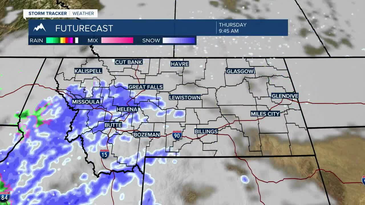
The bigger weather story is the transition from rain to snow as colder air settles into Southwest Montana. Snow will become more widespread in the mountains, while lower elevations and valleys gradually change from rain to snow as temperatures fall. Additional opportunities for snow remain in the forecast later this week and into the weekend.
