

BOZEMAN – A mild and windy southerly flow ahead of a large plume of warm, moist Pacific air developed over SW Montana Wednesday. Temperatures Wednesday afternoon is close to record high levels for a few locations.
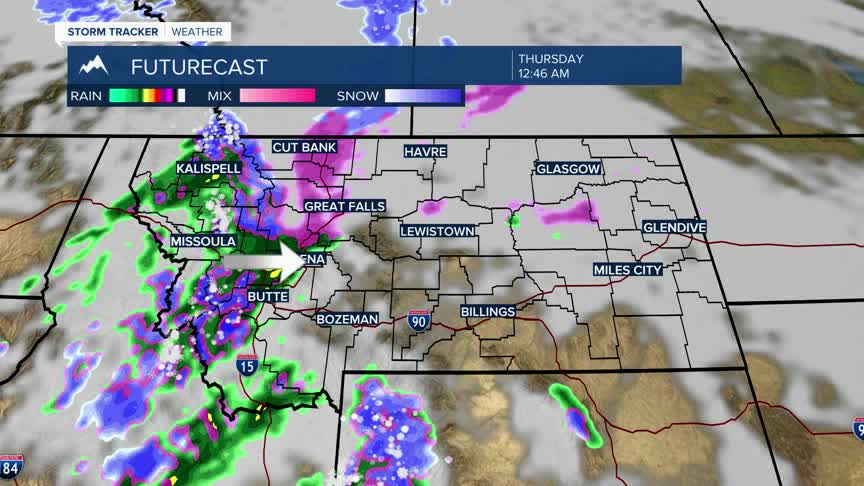
Increasing valley rain and higher mountain snow will develop Wednesday evening into Thursday morning. There could be pockets of mixed precipitation in the early morning hours with a slight chance for isolated areas of freezing rain.
Freezing rain could be more widespread over Northcentral Montana, north of Helena to Great Falls and Havre Wednesday evening through Thursday morning. Freezing rain could slowly drift eastward across the highline of Montana and eventually reach I-94 Thursday morning. There is a WINTER STORM WATCH up for possible freezing rain in NC Montana.
Scattered rain and snow will continue Thursday evening into Friday and with colder air dropping into the state from NW to SE this weekend look for scattered snow showers across the state with temperatures finally falling to normal levels. Highs in the 20s and 30s with single digit to low teens for lows this weekend.
