BOZEMAN – Record to near record lows this morning for SW Montana with upper 20s to mid 30s locally and only 1 reported new record low. Dillon airport down to 30° setting a new record low with the old record of 32° in 2017. Everyone else was just a few degrees warmer than records except Livingston was a good 10 degrees warmer than their record low.

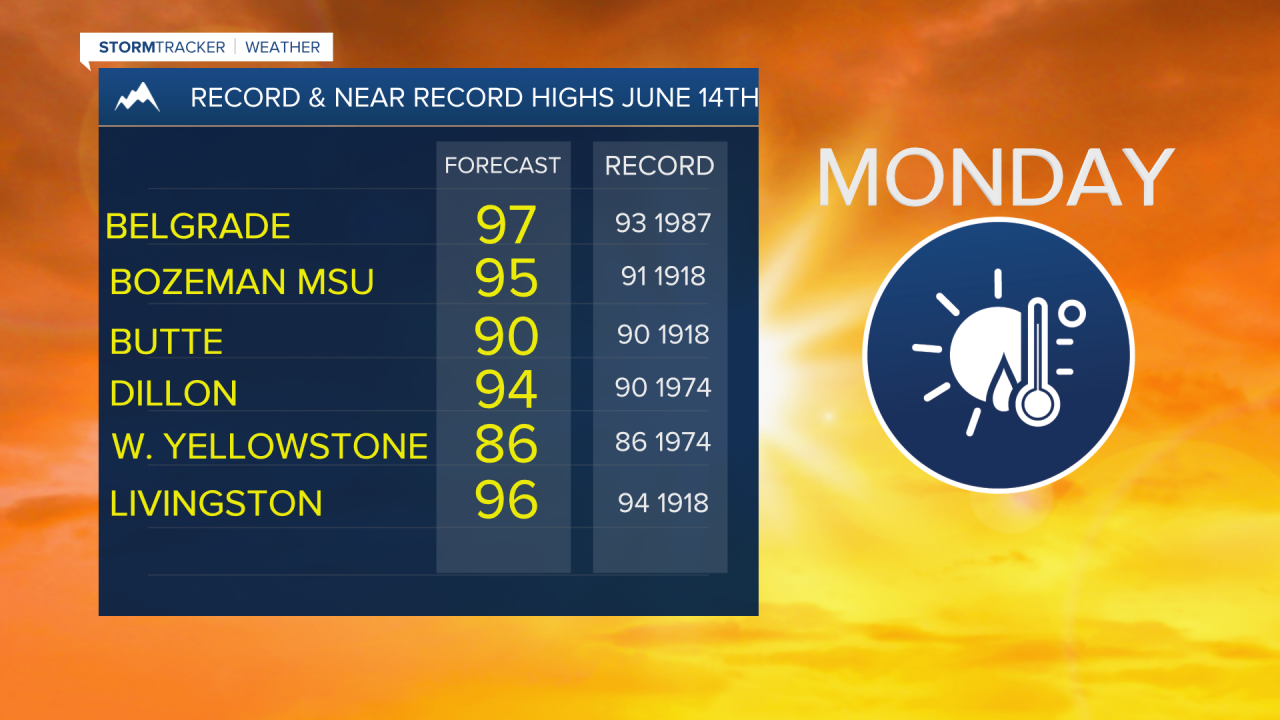
Heading into the weekend a rapid warm up is coming. Temperatures could jump above normal Saturday and begin to push close to record highs on Sunday. Bozeman MSU could tie or set a record high Sunday through Wednesday of next week.
The peak of the heatwave is likely to be on Monday and Tuesday. Some forecast highs are in the upper 90s with a slight chance for a few triple digit highs.
Temperatures will remain well above normal next week and mostly dry. This will only help the current drought conditions worsen for SW Montana.