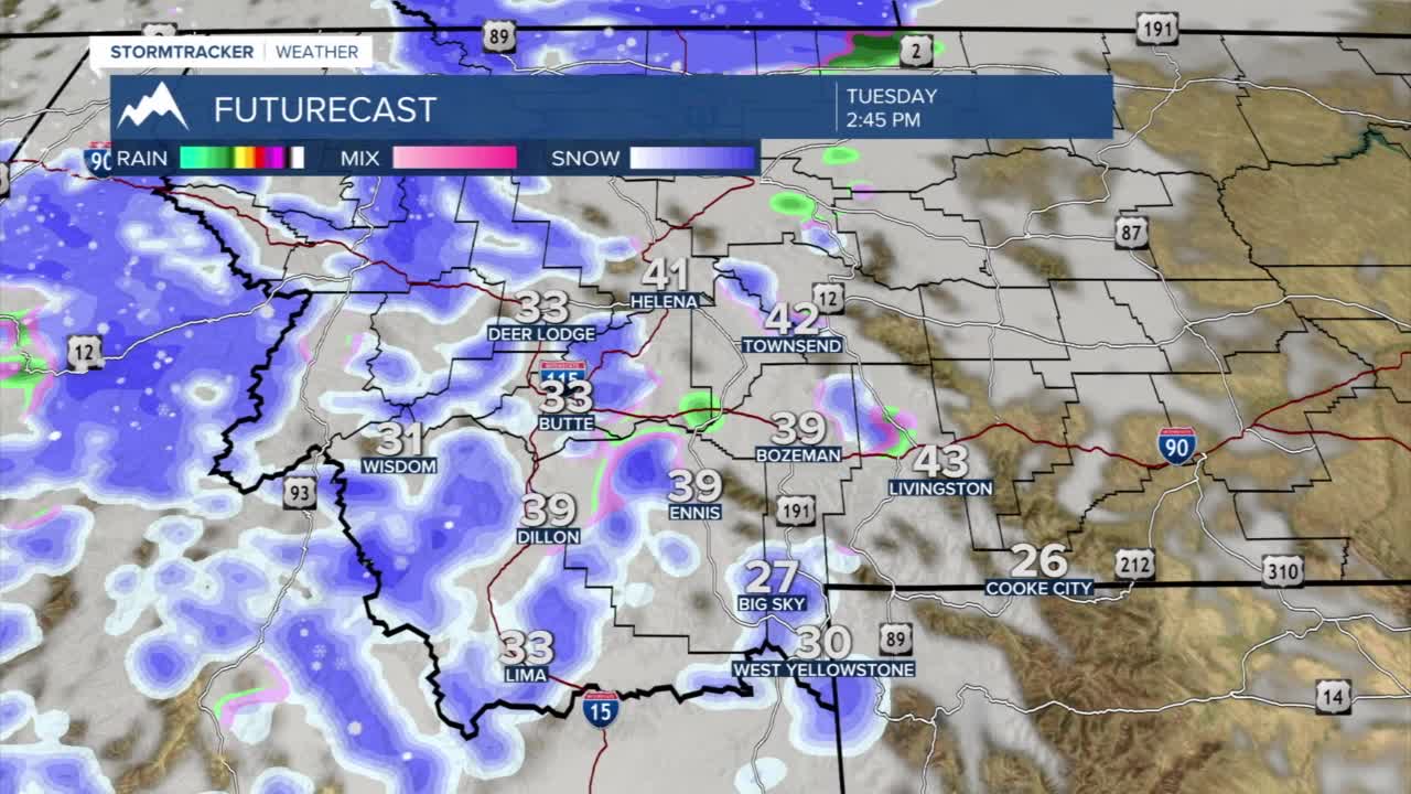


Today's Forecast: A cold front will move into the region for the afternoon with scattered snow showers for the mountains and a rain/snow mix late in the day for valleys. Temperatures will hold in the low and middle 40s in the afternoon with temperatures falling quickly for the evening. Accumulations will be between 1”-4” for most of the region overnight with most valleys picking up less than an inch of total accumulation. The Bozeman area could see between 1”-2” by early Wednesday.

BOZEMAN: High: 44; Low: 23. Clouds will roll in quickly for the afternoon with winds out of the west to northwest between 10-20 mph. Spotty rain showers will quickly transition to a rain/snow mix for the late afternoon with light snow overnight. The latest models show that we could see between 1”-2” by early Wednesday with heavier accumulations slightly over 2” possible.
BUTTE: High: 40; Low: 18. Chilly with mostly cloudy skies by the early afternoon. Temperatures will slowly cool for the afternoon with scattered rain/snow showers possible with limited accumulation likely by Wednesday morning.
DILLON: High: 41; Low: 18. Mostly cloudy skies with a strong west wind between 10-20 mph with isolated showers possible.
WEST YELLOWSTONE: High: 33; Low: 13. Cool clouds by the afternoon with light snow possible through the afternoon and evening. Accumulations by Wednesday morning should be between 1”-2”.
