


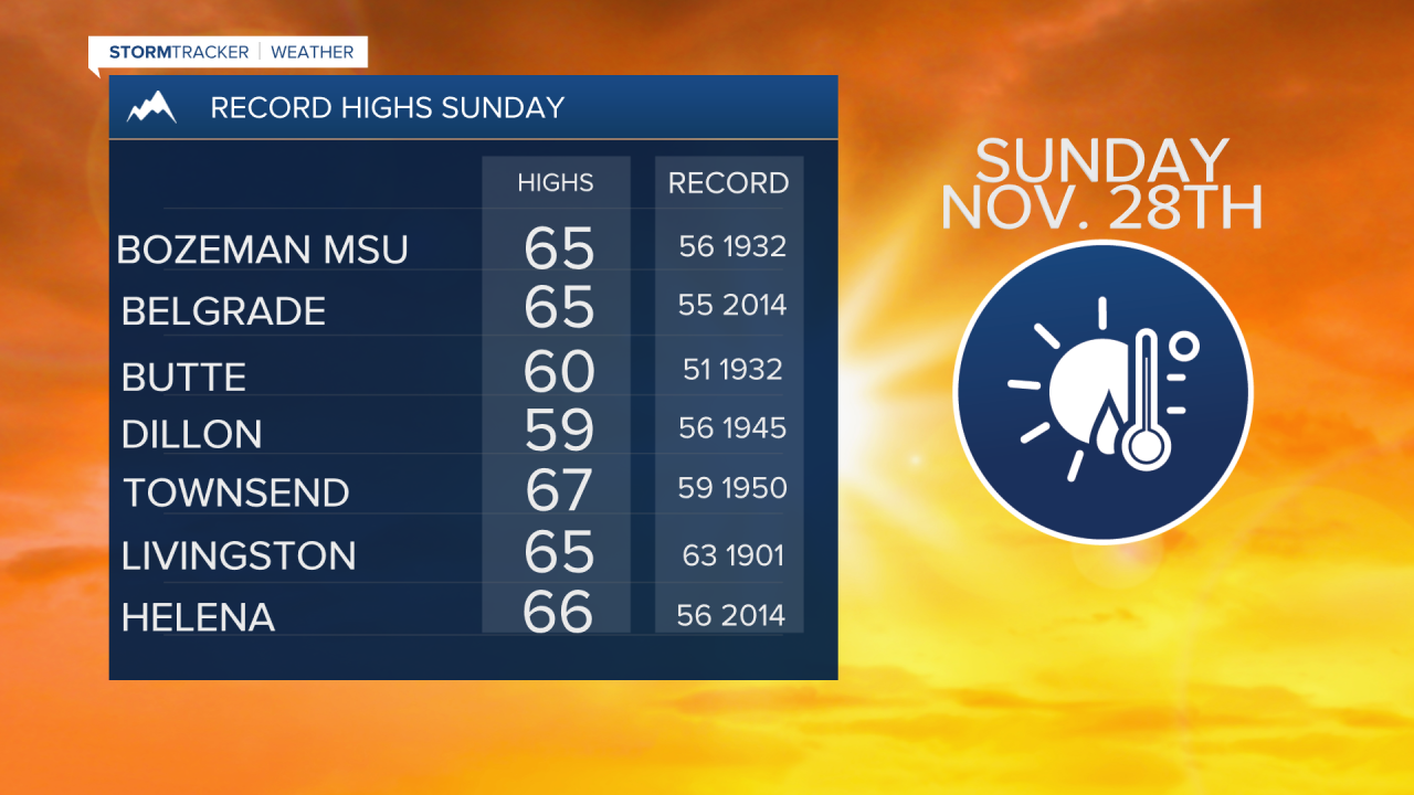
BOZEMAN – Unseasonably warm weather Sunday with numerous record highs reported both west and east of the Continental divide. Most reporting weather stations checked in with highs in the low to mid 60s Sunday afternoon. Here is a list of the new record highs set in SW Montana.
Another rapid warm up is coming Wednesday and again new record highs are possible. A slight cool down is occurring Monday afternoon as a weak disturbance is passing through the region producing scattered showers and some higher mountain snow.
Minor snow accumulations are possible for area mountain passes Monday night but should melt away with the continued above normal temperatures Tuesday.

A gradual cooling trend should begin later in the week through the weekend as temperatures fall down closer to normal levels.
The Climate Prediction Center 6 to 10 day and 8 to 14 day temperature outlooks through the first two weeks of December is calling for more of the same with above normal temperatures.
There is a good chance for increasing moisture through mid-December with hopefully some mountain snow.
