


BOZEMAN – A very unstable atmosphere is developing Wednesday through Friday over the entire region. Low-pressure over Spokane, WA will slowly spin through the region over the next the couple of days and with a strong High-pressure ridge over central Canada a classic convergence zone is setting up with plenty of lift and possible slower moving thunderstorms.
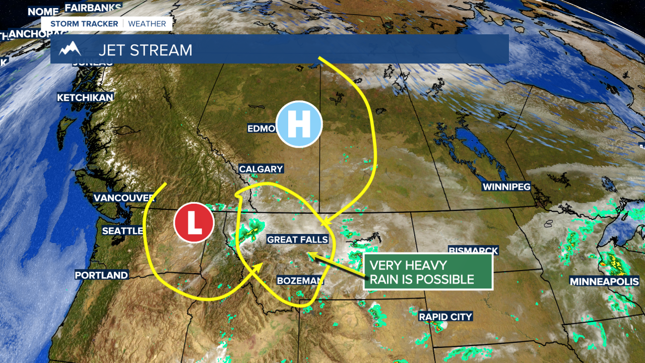
This pattern couple produce rainfall rates of 1”-2”+ per hour with the greatest threat in steep terrain along the Continental Divide and Rocky Mountain Front.
The National Weather Service has a FLOOD WATCH up west of the divide extending northward through this evening.

Flash flooding is possible and could washout roads in the mountains, but it could produce flooding in poor drainage areas for lower valleys.
Another round of slow-moving thunderstorms with pockets of very heavy rainfall are possible Thursday afternoon and evening especially east of the divide.
The Low-pressure system currently over Spokane, WA will spin into northern Montana Thursday into Friday and produce wrap around showers and thunderstorms some could linger into Friday morning or early afternoon.

Once this storm passes out of the region a cooler NW flow aloft will bring near normal temperatures to the state by the weekend into early next week.
