

BOZEMAN – The main concern in today’s forecast is slower moving thunderstorms producing locally heavy rainfall.
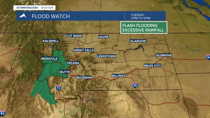
A Flood Watch is up for SW Montana West of the divide from 3 pm to 9 pm Tuesday for possible small areas of flash flooding that could occur if slow moving thunderstorms impact this region.
East of the divide could also see slower moving thunderstorms and brief heavy rainfall, however, the Storm Prediction Center has a “Slight” risk up for possible damaging thunderstorms over Northern Gallatin and Northern Park Counties. A small part of Broadwater and Southern Meagher Counties are also in the “slight” risk category.
This means there is a better chance some thunderstorms will be strong enough to produce damaging outflow peak wind gusts up to or over 60 mph and/or damaging hail up to or over an inch in diameter.
Monitor the KBZK STORMTracker Weather mobile app for frequent updates.
