


Today's Forecast:
A warm and unsettled day is in store for southwest Montana. Most locations will see partly cloudy skies early, but a wave of moisture moving up from Idaho will bring increasing clouds and a good chance for afternoon and evening showers or thunderstorms, especially for communities near the mountains. Winds will be generally light, and temperatures stay warm for the end of July.

BOZEMAN:
High: 86°F; Low: 51°F.
Morning sun gives way to increasing afternoon clouds. Showers and a few thunderstorms are likely after 2 PM, with the best rain chances heading into the evening. Thunderstorms could bring brief heavy rain and lightning. Winds remain light at 5–10 mph, shifting northwest after sunset.
BUTTE:
High: 80°F; Low: 47°F.
Partly sunny skies becoming mostly cloudy during the afternoon. Scattered showers and isolated thunderstorms develop late in the day and linger into evening. Winds light from the northwest. Expect minor cooling and improving sky conditions overnight.
DILLON:
High: 83°F; Low: 49°F.
A mix of sun and clouds through late morning, with a band of showers and storms likely arriving by midafternoon. Any storms could bring bursts of heavy rain and gusty winds. Skies begin to clear later tonight, with light west winds overall.
WEST YELLOWSTONE:
High: 73°F; Low: 39°F.
Sun gives way to clouds and a good chance for afternoon and evening showers or thunderstorms. Storms could produce brief heavy rain and isolated small hail. Winds west 5–10 mph, diminishing overnight.
DANGEROUS HEAT CONTINUES FOR NOW
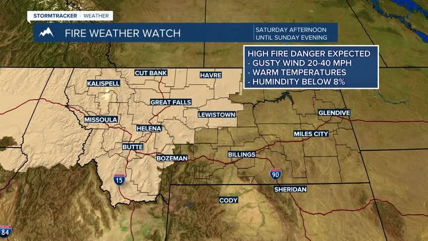
Heat continues through Saturday, with afternoon highs staying above average for late July. The daily chance of afternoon and evening storms persists for all of southwest Montana Thursday and Friday. Some storms could bring gusty winds with heavy rain. Fire danger remains elevated; please use caution outdoors. A gradual cooling trend and reduced storm chances are expected by Sunday and early next week.

