


BOZEMAN – Snow will develop over western and SW Montana Tuesday evening into Wednesday morning with a deep layer of dense cold Arctic air moving in right behind the snow Wednesday.
The combination of snow, blowing snow, snow-covered and icy roads, low visibility will produce hazardous travel conditions tonight into Wednesday morning but when you add below zero temperatures and dangerously cold wind chills this is a storm you need to take seriously.
There could be brief periods of heavy snow tonight with snowfall rates of 1”-2” per hour.
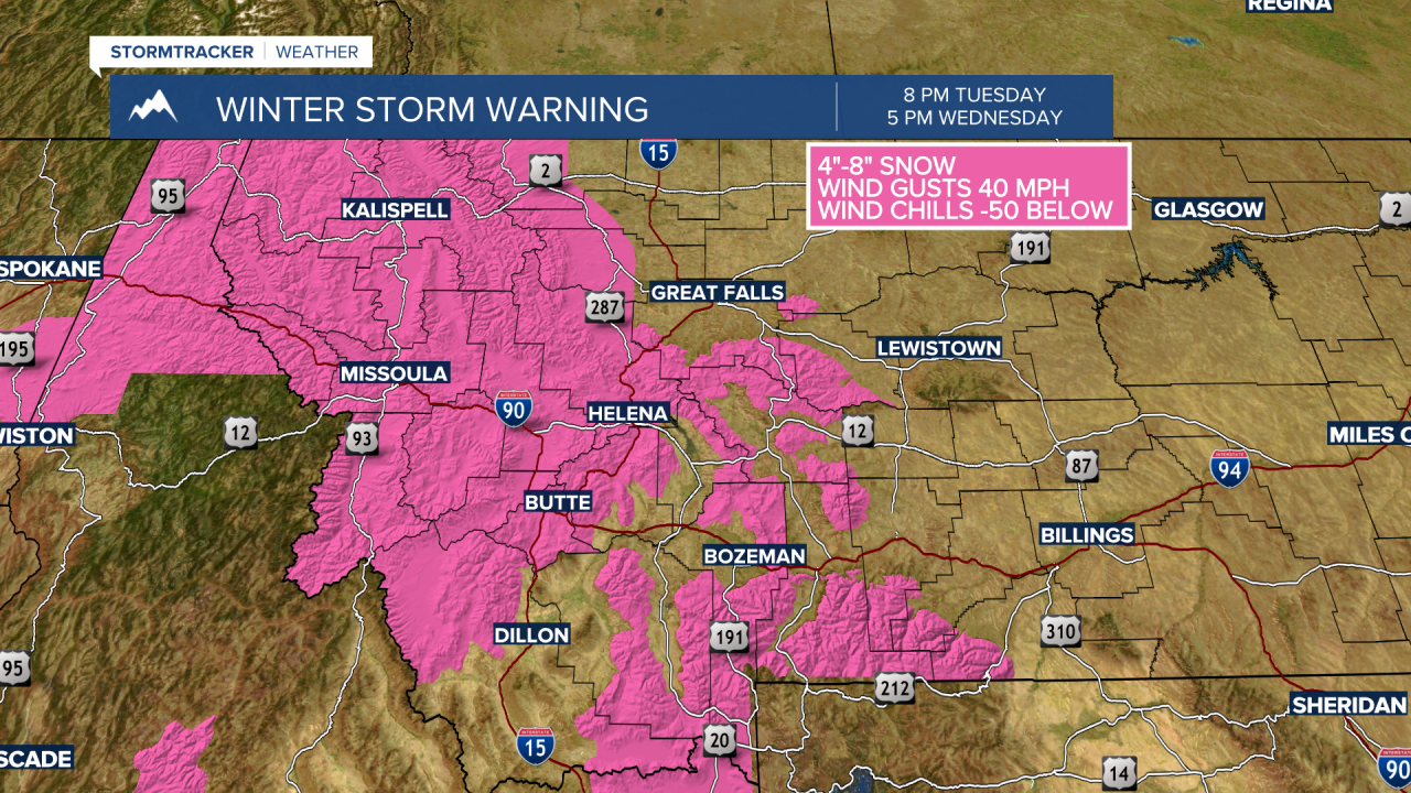
The National Weather Service continues a WINTER STORM WARNING for Montana west of the divide including Butte, Anaconda, Deer Lodge, and higher elevations like MacDonald Pass, Homestake Pass and Georgetown Lake. Snow totals of 4”-6” are possible with localized snow amounts over 8”. Wind gusts of 30 to 40 mph will produce blowing snow and low visibility along with wind chills as low as –50 below zero from 8 pm Tuesday to 5 pm Wednesday.

The National Weather Service continues a WINTER STORM WARNING for SW Montana east of the divide for mountains and passes through 11 am Wednesday. This includes Bozeman Pass, Big Sky, West Yellowstone, Targhee Pass, Raynolds Pass. Snow accumulations of 3”-8” is possible. Wind gusts of 30 to 40 mph are possible producing blowing and drifting snow with low visibility and wind chills of –50 to –60 below zero.
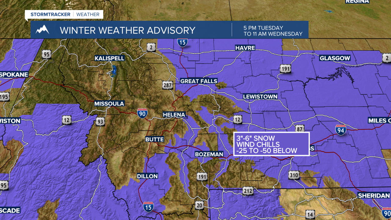
The National Weather Service continues a WINTER WEATHER ADVISORY for SW Montana east of the divide for lower valleys through 11 am Wednesday. This includes Bozeman, Belgrade, Three Forks, Ennis, Dillon, Whitehall, Livingston to Billings, Townsend to White Sulphur Springs. Snow accumulations 2”-6” is possible. Wind gusts of 25 to 35 mph will produce areas of blowing and drifting snow with low visibility, and wind chills of –50 to –60 below zero.
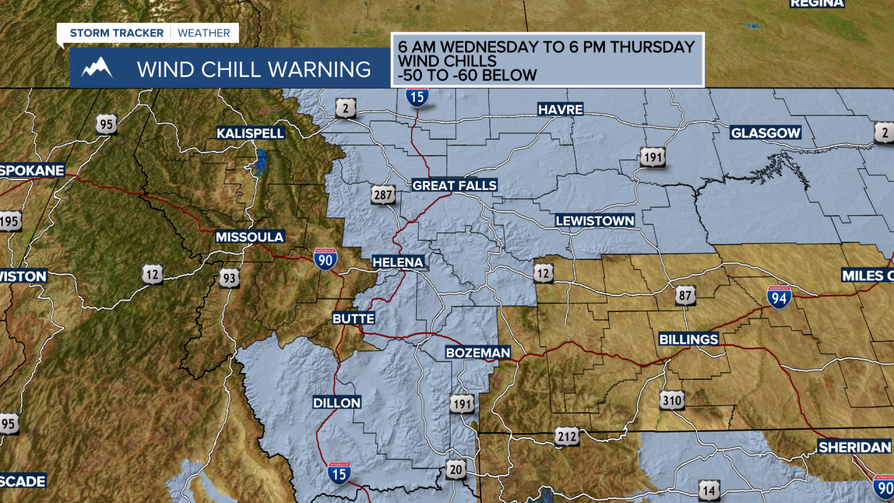
The National Weather Service continues a WIND CHILL WARNING for SW Montana east of the divide from 6 am Wednesday to 6 pm Thursday. Feels like temperatures of –50 to –60 below zero are possible. This means frostbite and hypothermia can occur within 10 to 30 minutes.
Forecast morning lows for Thursday morning will be extremely difficult to predict as most forecast models do not handle extreme cold events like this very well. A lot will depend on cloud cover or lack of cloud cover. If skies clear rapidly by Wednesday early evening temperatures could be colder than predicted. If we manage to hold on to a thick layer of clouds Wednesday night temperatures could be a little warmer than predicted.

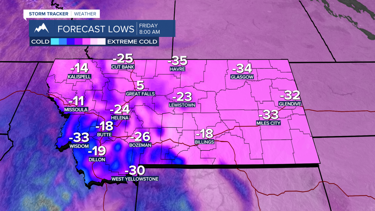
The bottom line here is that extremely cold temperatures are predicted and most of SW Montana could see lows between –25 to –55 below zero with wind chills –50 to –60 below zero. This is a life-threatening weather event, and you need to be prepared.
