


Today's Forecast:
Snow is winding down across Southwest Montana early Wednesday after an overnight system brought accumulating snow to several valleys and mountain passes. A Winter Weather Advisory remains in effect around Bozeman and Dillon until 11 a.m. Roads may remain slick through the morning commute before conditions improve. Skies gradually clear from west to east, with more sunshine developing this afternoon.
Morning Road Report:
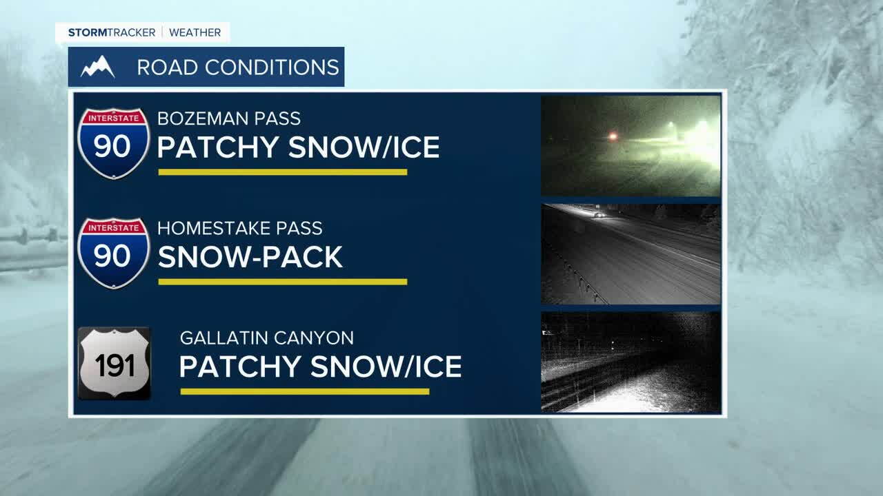
Use extra caution during the morning drive. Bozeman Pass received overnight snow, leaving snowpacked, slushy and icy stretches are a concern before conditions improve later this morning. Homestake Pass, temperatures are below freezing early Wednesday following the snow, so watch for snowpacked or icy stretches.
Through the Gallatin Canyon, colder temperatures and recent snowfall mean drivers should remain alert for slick and snowpacked stretches, particularly in shaded areas and closer to West Yellowstone.
BOZEMAN:
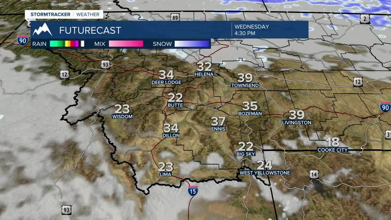
High: 37; Low: 23. Clouds and fog gradually clear through the morning with sunshine developing this afternoon. West to southwest winds around 5 to 9 mph become lighter later today. Clouds increase again tonight.
BUTTE:
High: 35; Low: 18. Sunshine returns Wednesday following the recent snow. Southwest winds remain fairly light around 8 mph, with clouds beginning to increase again tonight.
DILLON:
High: 37; Low: 23. Sunshine returns Wednesday after the early snow, with southwest winds around 5 to 15 mph. Clouds increase again tonight as the next weather system begins approaching.
WEST YELLOWSTONE:
High: 27; Low: 16. A few early snow showers give way to gradual clearing and increasing sunshine. Southwest winds could gust around 20 mph. Clouds increase again tonight ahead of another round of snow.
MORE SNOW CHANCES LATE THIS WEEK
The break in the weather will not last long. Clouds increase Thursday as another system approaches, with snow chances returning Thursday into Friday. Around West Yellowstone, snow becomes likely Thursday and continues Thursday night into Friday. Around Bozeman and Butte, snow chances increase Thursday night with snow likely Friday morning.
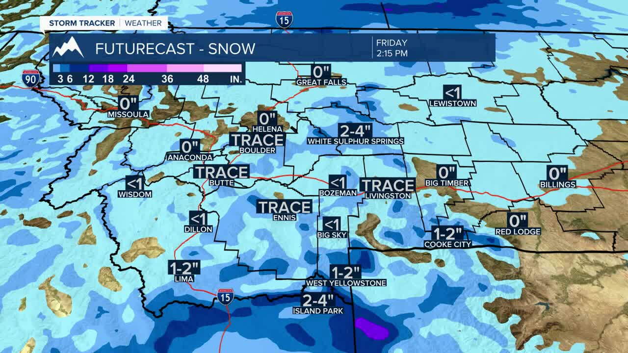
Temperatures remain seasonably cold into the weekend, with additional periods of mountain and valley snow possible before somewhat quieter conditions develop later in the weekend
