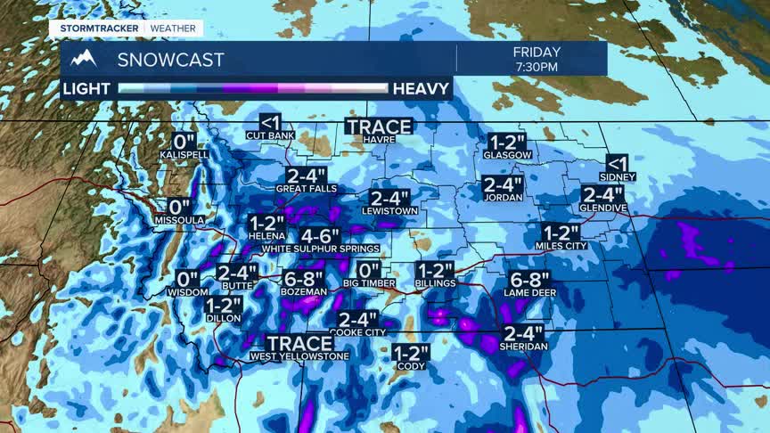


BOZEMAN – A beautiful Spring snow storm will continue to impact Montana through Friday afternoon. The storm is slowly moving to East SE over the next 24 hours and that means a high probability of rain/snow for lower valleys and heavy wet mountain snow.
This storm will impact travel conditions over all area mountain passes with slush covered to snow covered and icy road surfaces and thus impacting Thursday evening and Friday morning commutes.
The National Weather Service continues a WINTER STORM WARNING east of the divide with the heaviest snowfall expected over the Bridger, Gallatin, Madison, Centennial, Absaroka-Beartooth, Grazy mountain ranges and Yellowstone National Park through noon Friday.
This WINTER STORM WARNING includes Bozeman Pass.
Winter Weather Advisories are up for most other areas of SW Montana including west of the divide with moderate snowfall above 5,000’ through Friday morning.
This storm will be exiting the region by Friday afternoon and a warming and drying trend is expected for Easter weekend.
