


Today's Forecast:
Thursday is expected to bring a few strong thunderstorms back to the area as our daytime highs build into the middle 80s to near 90°. Our main concerns will deal with the potential for small to moderate hail of 1” and winds in excess of 58 mph or greater. We also have a few select areas in the Bridger Mountains, Castle Mountains, and Little Belt Mountains that are looking at a Flash Flood Watch from 2 PM through midnight for burn scar areas. Most of our thunderstorm chances are between 2 PM and 8 PM today before the rain clears the area.
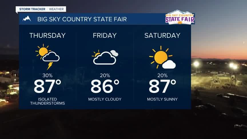
BOZEMAN: High: 87; Low: 60. Clear skies are expected until scattered thunderstorms fire off across the region around 2 PM. A few storms will bring small pockets of intense rainfall, 1” hail, and the potential for gusty wind. We will primarily see winds out of the southeast between 5-10 mph with the exception of gusty winds from area t-storms. Our best timeframe for t-storms appears to be between 4 PM and 7 PM tonight. Showers will fade quickly tonight with another round of storms again Friday.
BUTTE: High: 85; Low: 56. A couple of thunderstorms are expected this afternoon after a sunny start to the day. Once temperatures hit the low 80s we will see clouds develop and storms to fire off in the area. A few storms could bring intense rain, gusty wind, and the potential for some intense downpours. Our chance for rain will begin to fade after 6 PM tonight and leave us with partly cloudy skies for the evening.
DILLON: High: 87; Low: 59 Clear skies will push our daytime highs into the middle 80s by the early afternoon. With warm temperatures in place we will see a few t-storms develop starting around 2 PM and will quickly push east out of the area. A few storms could be strong and could bring gusty wind from the base of a few of those storms. While we see the chance of some intense t-storms, these showers are developing over Beaverhead county and moving eastward with the chance of several strong storms to our east through the early evening.
WEST YELLOWSTONE: High: 85; Low: 49. A few t-storms are likely this afternoon. The strongest storms are expected to the north. Most of the storms are expected after 3 PM and should fall apart pretty quickly after 6 PM tonight. There is potential for gusty winds from a few of these storms.
STORM OUTLOOK FOR THURSDAY AND FRIDAY
Southwest Montana will be the focus for severe weather for the mountain west today. The Storm Prediction Center out of Norman, Oklahoma has issued a ‘Slight Risk’ for severe weather for your Thursday afternoon. Our main concerns are hail and damaging wind. These storms are expected to develop quickly starting around 2 PM as the temperatures climb and will intensify through the afternoon in the warmer air.

We are also looking at the potential for some brief but intense downpours from a few of these storms. Because of that we have a Flash Flood Watch for the Castle Mountains, the Bridgers, and the Little Belt Mountains. This is specifically for burn scar areas but the intense rain could bring some localized flooding concerns to a few areas.

The latest weather data shows that more storms are possible for Friday. While we don’t expect the same intensity of those storms on Friday right now, we definitely could see some severe weather potential from those storms as well. Be prepared for a few damaging storms for Thursday and Friday.
