


BOZEMAN – The atmosphere is becoming highly unstable Tuesday afternoon as a Pacific cold front is slowly digging into the Pacific NW. This is creating a warm to hot SW flow with increasing moisture and strong surface heating adding additional lift.
This all means thunderstorms are likely to develop and a few could turn strong with an isolated severe thunderstorm possible over SW Montana extending into central counties of Montana.
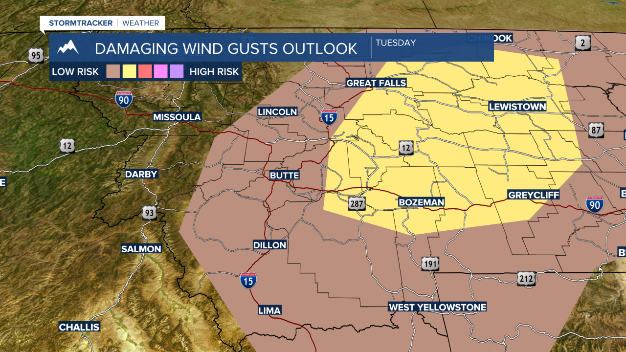
The Storm Prediction Center has a “marginal” risk in green and a “moderate” risk in yellow for strong to severe thunderstorms to develop Tuesday afternoon.

The greatest concern is damaging outflow peak wind gusts around the thunderstorms. The Storm Prediction Center has a higher risk of damaging wind gusts in the area highlighted in yellow.
Some storms could produce small hail and brief heavy rain with frequent lightning. Seek shelter if thunderstorms approach your area.
Temperatures will be slightly cooler beginning Wednesday but the forecast for the rest of the week is mostly dry.
By the 4th of July holiday weekend look for increasing temperatures and there is a slight chance for a few pop-up thunderstorms.
