

BOZEMAN – Another wind event coming to Montana Saturday. A new Pacific storm, cold front and upper-level Low is dropping SE through British Columbia, Canada Friday afternoon and heading toward Montana Saturday.
This storm will produce very strong surface wind gusts and even stronger gusts along ridge-tops above ground level.
There will be some mountain snow with this system as well and combination of snow and wind could produce difficult travel conditions for mountain passes across the state Saturday afternoon through Sunday morning.

Behind this front a cooler than normal temperature pattern will begin on Sunday and should continue throughout most of next week. Forecast highs and lows will only be in the 30s and 40s.
The greatest weather impact from this storm system on Saturday is peak wind gusts. Most areas locally in SW Montana could see peak gusts over 30 mph but high wind prone regions could see peak gusts up to 60+ mph Saturday afternoon.
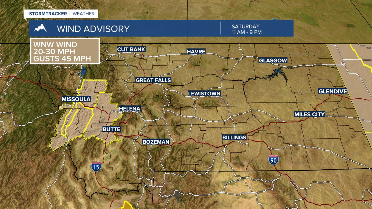
The National Weather Service has issued a WIND ADVISORY for the Butte/Blackfoot region Saturday 11 am to 9 pm.
Sustained wind 20 to 30 mph and gusts to or over 45 mph are likely. Look for blowing dust and difficult travel in crosswind areas and over mountain passes with snow and wind producing lower visibility.

The National Weather Service will likely issue additional wind highlights with their updates later Friday afternoon. Updates on wind impacts with Chief Meteorologist Mike Heard live weather at 5:30 pm and 10 pm Friday evening.
