

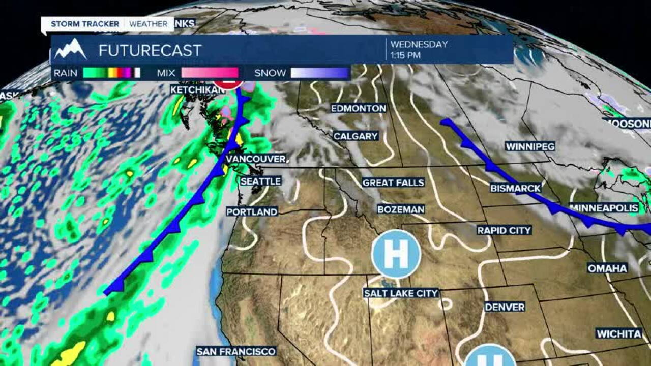


Today's Forecast
Veterans Day will bring plenty of sunshine and unusually mild November temperatures across southwest Montana. Bozeman climbs into the lower 60s, while even the normally colder West Yellowstone area reaches around 50. Winds remain light, making for a very pleasant November afternoon. Clouds increase tonight, but conditions remain dry.
BOZEMAN
High: 60; Low: 36.
Sunny and very mild for Veterans Day with temperatures climbing to around 62. Winds will be light, with a southeast breeze becoming calm during the morning. Clouds increase tonight with temperatures falling into the middle 30s.
BUTTE
High: 60; Low: 27.
Mostly sunny and mild conditions are expected for Veterans Day. I could not verify today's exact Butte high and tonight's low from the original point forecast, so I'm leaving those two numbers open rather than estimating them.
DILLON
High: 60; Low: 32.
Sunshine and unseasonably mild conditions will dominate Veterans Day. I could not verify today's exact Dillon high and tonight's low from the original point forecast, so I'm leaving those numbers open rather than inserting unsupported values.
WEST YELLOWSTONE
High: 51; Low: 21.
Mostly sunny skies are expected with a high around 50. Winds remain light, becoming south-southwest around 6 mph during the afternoon. Clouds increase tonight with temperatures dropping into the upper 20s.
Looking Ahead
The warmth sticks around through the end of the workweek. Bozeman reaches the lower 60s again Thursday before settling near 60 Friday. West Yellowstone reaches the lower 50s Thursday before returning to around 50 Friday.
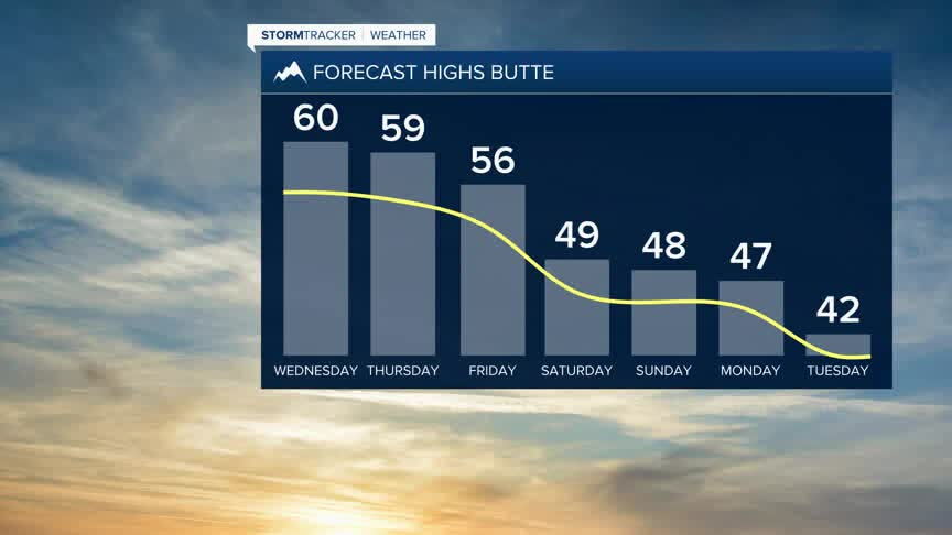
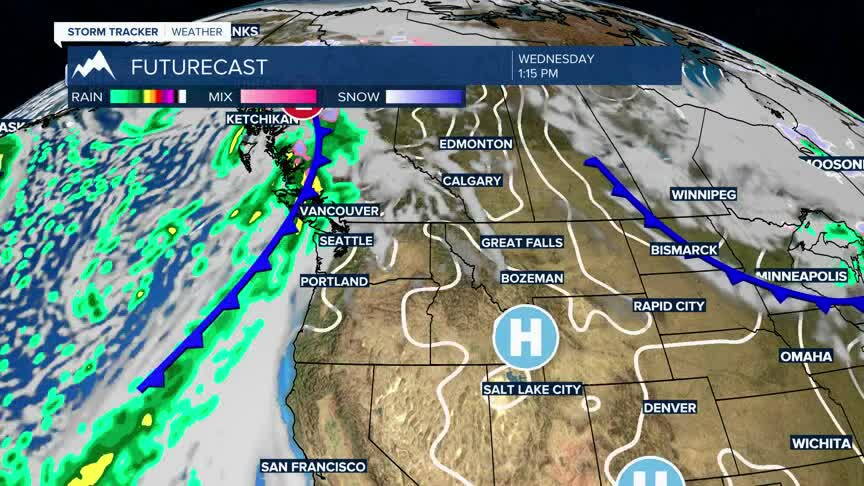
Things begin changing this weekend as the ridge responsible for our unusually warm weather starts to weaken. Temperatures will cool, but this isn't a dramatic plunge into winter. Bozeman is still expected to reach the middle 50s Saturday and lower 50s Sunday, while the West Yellowstone area falls into the middle 40s Saturday and around 40 Sunday. In other words, cooler is coming, but temperatures should remain relatively mild for mid-November.
The more interesting change is happening higher in the atmosphere. As the ridge weakens and the flow becomes more favorable for Pacific moisture, we'll begin opening the door to more frequent weather systems. The first precipitation chances begin appearing this weekend, initially favoring the mountains.
That transition becomes more noticeable next week. By Tuesday, Bozeman has a chance for both rain and snow with a high dropping into the middle 40s, while rain and snow become likely around West Yellowstone.
The bigger picture is more important than any one storm right now. We're transitioning from the warm and relatively dry pattern we've been enjoying toward a cooler and more active Pacific pattern. That should provide more opportunities for valley rain and mountain snow next week and favor a trend toward above-average precipitation.
