


BOZEMAN – Warm and windy weather will persist through Friday and possibly into the weekend. The biggest weather hazard for those traveling with high wind gusts mostly east of the divide.
The National Weather Service continues a WIND ADVISORY for the Livingston area through Friday evening. SW wind holding steady between 30 to 50 mph and at time peak gusts could be as strong as 70+ mph.
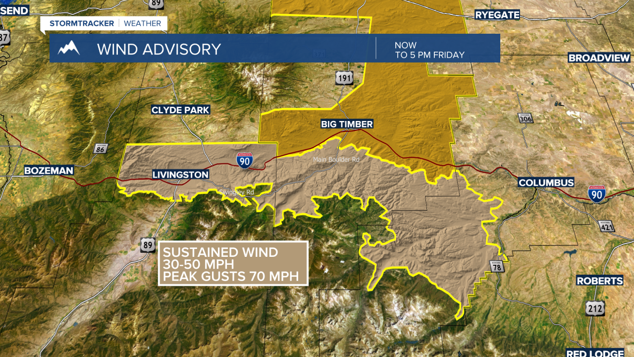
The National Weather Service has a HIGH WIND WARNING up from Big Timber to Harlowton through Friday evening. Peak wind gusts up to or over 60 mph are possible.

The National Weather Service also continues a HIGH WIND WARNING for the northern front range and adjacent areas near Great Falls to Lewistown. Peak wind gusts along the Rocky Mountain Front could reach the 60 to 80 mph range. Lewistown to Cut Bank peak gusts around 60 mph are possible.

Why so wind? High pressure is building over California and the Polar Jet Stream is forced to funnel through the Pacific NW and push through Montana. Those powerful mid to high level winds crossing over the Rocky Mountain Front and Continental Divide produce strong downsloping wind gusts.
Storm after storm will be pushing through Washington state and British Columbia with heavy rain and heavy mountain snow through early next week. As these storms move inland, they weaken substantially leaving only a slight chance for rain or snow over SW Montana but a higher probability for rain and snow over NW Montana.
Lookout Pass on I-90 could see periodic rounds of snow over the next few days and there could be some wintry travel conditions so plan ahead for slow-go travel.
Unseasonably warm temperatures are in the forecast through the middle of next week. Average or normal highs and lows for SW Montana are mostly in the mid 30s for highs and teens for morning lows. Forecast highs are between 10 to 20 degrees above normal locally and the morning forecast lows will be around 20 degrees above normal.
Sunday there could be near record highs, tied record highs, and even some new record highs in SW Montana.

