


BOZEMAN – A deep trough of Low-pressure is developing along the west coast and will slowly migrate inland beginning Tuesday and reaching Montana by Wednesday.
This changing weather pattern will produce a wide variety of conditions. First, warm and windy Monday into Tuesday. Surface peak gusts could reach 30 to 60+ mph especially in high wind prone regions within SW Montana. A cold front will pass through by Wednesday morning. This will kick off a cooling trend that should linger for the rest of the week.
A large plume of moisture will follow the jet stream and aim mostly for western and NW Montana counties. This region will have a higher probability of rain and snow with higher mountain snow possibly over a foot in NW Montana.
SW Montana will see scattered rain or snow out of this storm system with snow accumulations on lower side compared to NW Montana but several inches are possible for mountain passes and pockets of moderate snow for higher elevations.

Look for more wintry weather to redevelop possibly by the weekend with rain or snow Saturday changing to all snow by Sunday along with cooler than normal temperatures.
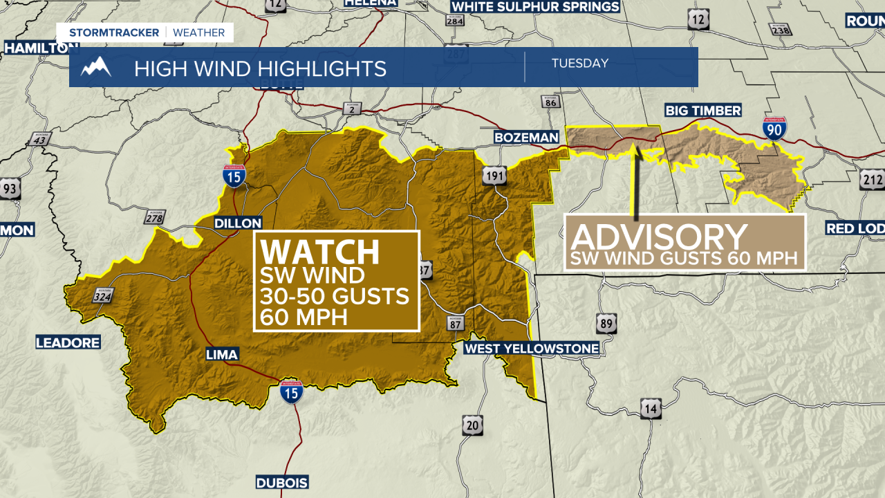
The National Weather Service has issued a HIGH WIND WATCH for Beaverhead, Madison, and Gallatin Counties Tuesday afternoon and evening.
SW wind between 30 to 40 mph is likely and peak gusts up to or over 60 mph is possible.
The National Weather Service issued a WIND ADVISORY for the Livingston area Monday into Tuesday. Peak gusts up to or over 60 mph are possible. The Livingston area will experience crosswind gusts strong enough to impact travel on I-90.
