

Bozeman – Southwest Montana is enjoying a break in active weather Tuesday as a weak high-pressure system settles over the state, creating temperature inversions in valleys across western Montana and central Idaho.
Under mostly sunny skies, much of southwest Montana saw slightly warmer temperatures Tuesday, enough to melt lingering snow on roads.
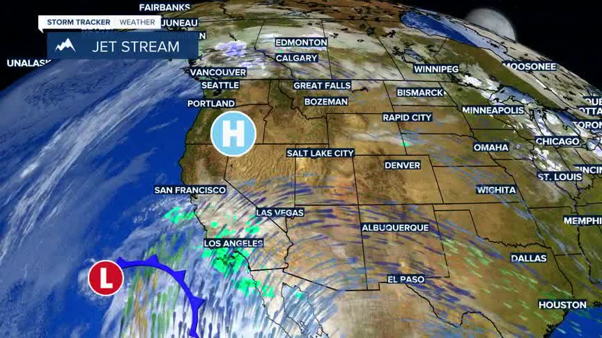
But changes are on the horizon. A Pacific storm currently stalled off the southern California coast is set to track northward, bringing the region its next shot of wintry precipitation. By Thursday afternoon, scattered rain and snow showers are expected to develop across southwest Montana.
Forecasters say the highest chance for minor snow accumulation will be in southern Beaverhead, Madison, and Gallatin counties — from Monida Pass to West Yellowstone — where 1 to 4 inches of snow could fall by Thursday evening.
A southwest flow aloft will keep temperatures running slightly above normal through the rest of the week.
