

BOZEMAN – The next weather-maker will bring another round of strong winds to the state along with periods of valley and mountain snow.
That combination will create difficult to hazardous travel conditions Thursday evening through Friday evening.
Valley snow accumulations between 1”-4” is possible with some higher amounts around Wisdom, West Yellowstone to Big Sky, and mountain passes could see 3”-8” of snow.
The National Weather Service has issued WINTER WEATHER ADVISORIES from 6 pm Thursday to midnight Friday,for the upper Big Hole region, Madison and Gallatin Ranges, and Island Park, ID. General snow accumulations between3”-6” is likely with10”+possible above 7,000’. Wind gusts to 50 mph could create areas of blowing snow and lower visibility at times.
The National Weather Service issued a WINTER STORM WARNING now through Saturday morning for the Absaroka-Beartooth Range. 1 to 2 feet of snow is possible along with wind gusts up to 75 mph. This will create dangerous back-country conditions.
The National Weather Service issued a WINTER STORM WARNING from 5 pm Thursday to 5 pm Friday for the Bitterroot and Sapphire Mountains. 8”-14” of snow is possible for Lolo Pass with 16”-24” for Lost Trail Pass.Also,wind gusts 35 to 45 mph will create considerable areas of blowing snow and reduce visibility which will create hazardous to dangerous travel conditions at times.
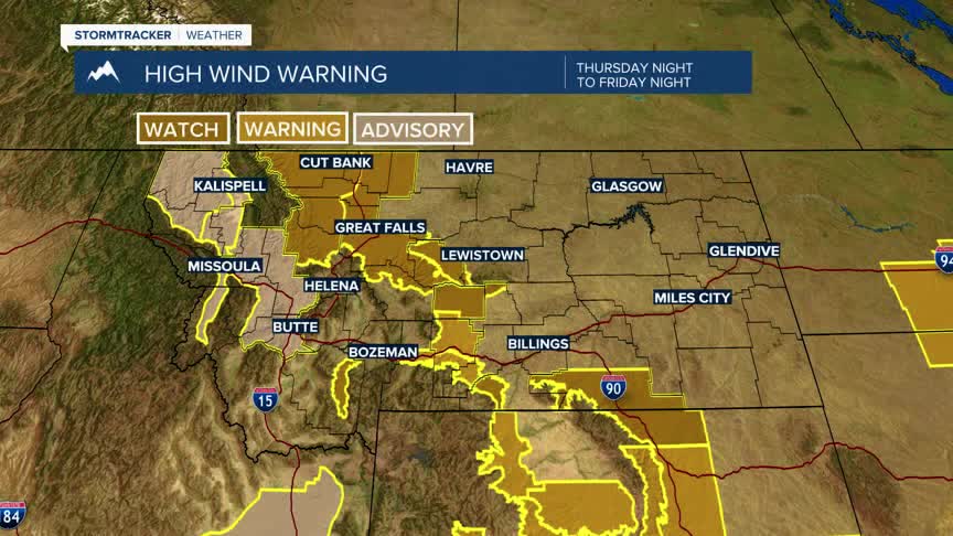
Finally, more wind will impact most of Montana Thursday night through Friday night.
The National Weather Service has issued a WIND ADVISORY from 2 am to 11 am for the Butte/Blackfoot Region. West winds 20 to 30 mph with gusts up to 55 mph are possible for the Butte, Anaconda, Deer Lodge, Philipsburg region. There will be scattered snow showers at times along with the windy conditions which could produce localized areas of blowing snow.
The National Weather Service issued a HIGH WIND WARNING for the Madison River Valley from 6 pm Thursday to 6 pm Friday,this includes Ennis and Norris Hill. South winds 35 to 45 mph with gusts up to 65 mph are possible. There will be some scattered snow showers along with the strong wind gusts and thus watch for localized areas of snow squalls, blowing snow and reduced visibility on US 287.
The National Weather Service has issued a HIGH WIND WARNING now through 2 pm Friday for the Livingston and Beartooth Foothills, Big Timber northward to Harlowton. SW Wind gusts up to 75 mph are possible. Strong crosswinds will impact I-90 from Livingston to Big Timber.
