


BOZEMAN – Upper-level trough is parked over Idaho and Montana Friday afternoon producing more wind and scattered snow. So far this is having a minor impact on travel conditions especially for mountain passes on the MT/ID state line.
This cold and unsettled pattern will linger over the region through Saturday. Colder than normal temperatures, scattered snow, and locally windy conditions will continue to produce wintry travel conditions for SW Montana.
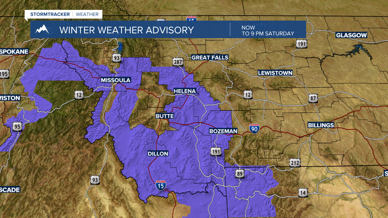
The National Weather Service has issued a WINTER WEATHER ADVISORY for most of SW Montana through 9 pm Saturday.
Periods of off and on snow with an additional 6” is possible for mountains and passes and localized wind gusts to 35 mph will produce blowing snow and lower visibility.
Lower valleys could see some light snow occasionally Friday night through Saturday night.

A slow warming trend is still on track to begin Sunday through most of next week.
