BOZEMAN – A Pacific storm system will pass through the Pacific NW and northern Rockies tonight through Wednesday.
This storm will bring some challenging travel conditions especially over mountain passes with accumulating snow, gusts winds, and low visibility at times.
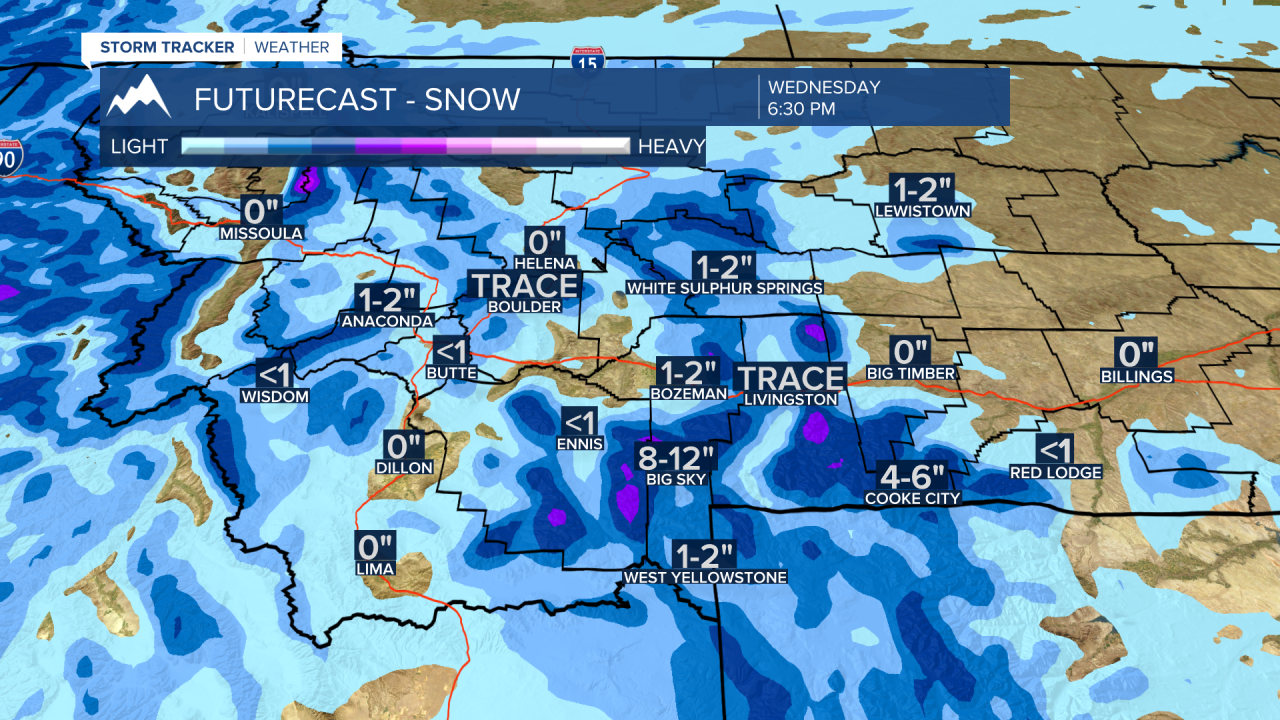
The good news is this storm will pass through quickly and should be gone by Wednesday evening.
Thursday through Friday also look quiet and mild overall. The next big weather change will begin over the weekend with another cold front late Saturday and another cold snap through most of next week with periods of snow.
Thanksgiving travel could be wintry Wednesday and again on Sunday.
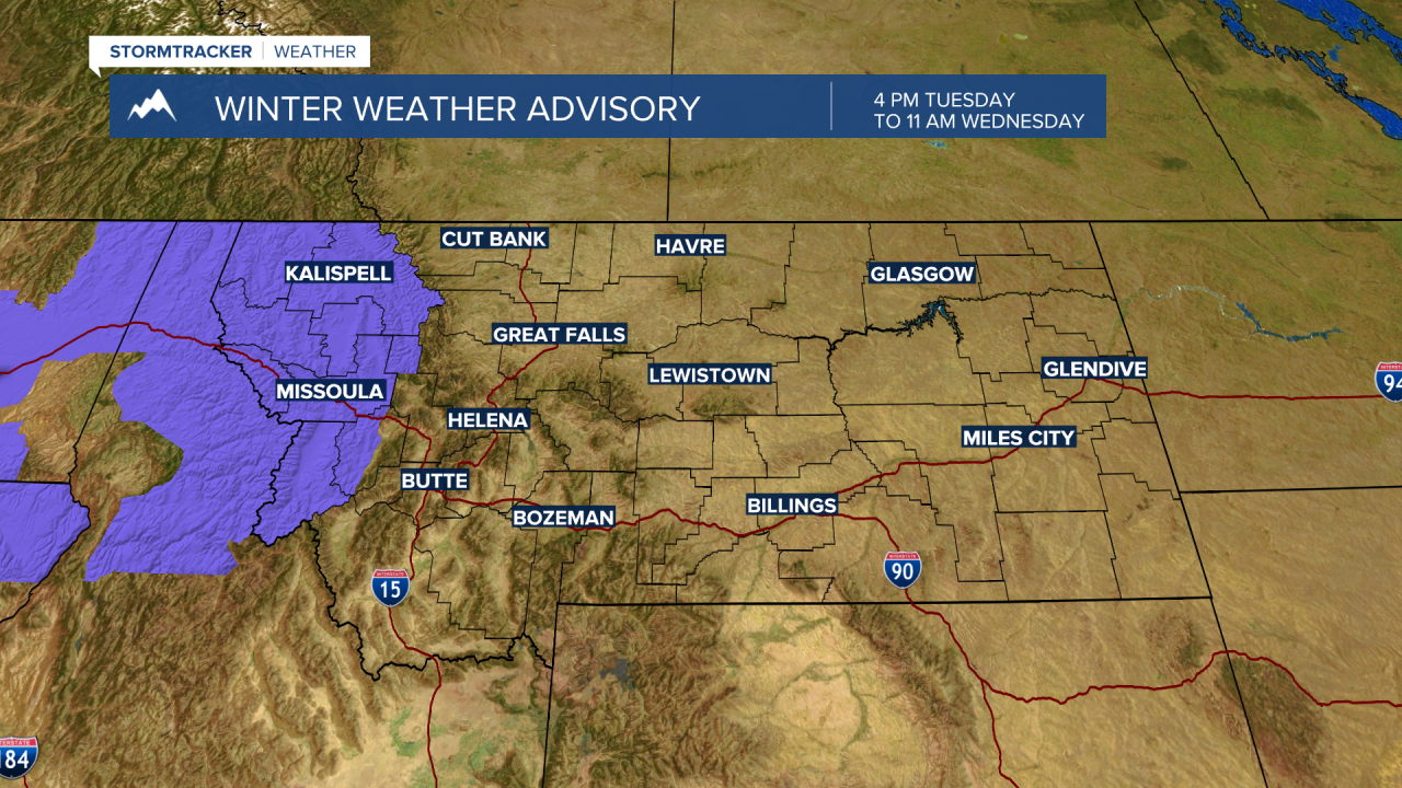
The National Weather Service has a WINTER WEATHER ADVISORY up for western Montana through eastern Washington. Valley snow 1”-3” and at pass level 3”-6” of snow is likely. There is a slight chance for valley rain or snow at times which could produce very icy road conditions. The biggest travel impacts will be from Missoula westward and up into the Kalispell area.
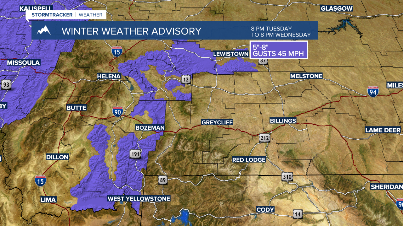
The National Weather Service issued a WINTER WEATHER ADVISORY for SW Montana for mountains and passes east of the divide in Madison, Gallatin, Broadwater, and Meagher Counties. Mountains and passes could see up to 5"-8" of snow along with wind gusts to 45 mph. Bozeman Pass, Raynolds Pass, Targhee Pass, Kings Hill Pass, Battle Ridge Pass, and West Yellowstone will see difficult travel conditions.
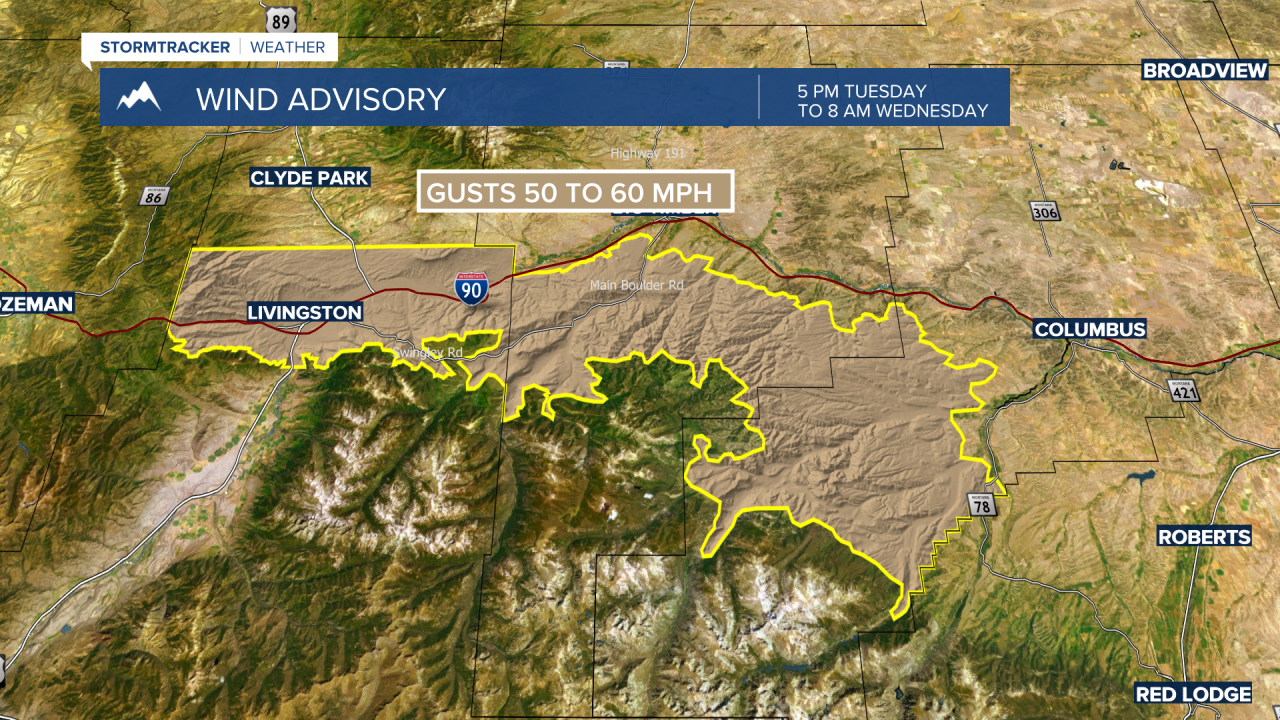
The National Weather Service has issued a WIND ADVISORY for the Livingston area. Gusts 50 to 60 mph are possible Tuesday afternoon through Wednesday afternoon. Strong to dangerous crosswinds are possible in the Livingston area of I-90.